Skip to content
Brighton Antique Prints and MapsBrighton Antique Prints and Maps
  • CURRENCY

    WOOCS 2.1.5
  • VIEW CART
  • Catalogue
  • Home
  • Catalogue
    • Antique Maps
    • Antique Prints
    • Books & Gov’t Reports
    • Manuscript Documents
  • Recent Arrivals
  • About
  • FAQ
  • Register Interests
  • Contact Us
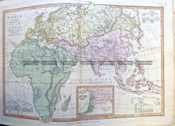
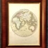
Antique Map - Orbis Secundum Strabonem c.1800  Ref: 237-336
Home / Antique Maps / World / World and Hemispheres
  • 16-253 - Description of the Earth - Dunn

Antique Map – Orbis Secundum Strabonem c.1800 Ref: 237-336

  • 16-253 - Description of the Earth - Dunn

$75.00

Category: World and Hemispheres
  • 16-253 - Description of the Earth - Dunn
Product Categories
  • Antique Maps
    • World
      • World and Hemispheres
      • Antarctica & Arctic
      • Thematic
      • Celestial
    • Australia & Pacific
    • Britain and Ireland
    • Europe
    • Asia
    • North America
    • South America
    • Africa
    • City Street Maps
    • Geological maps
    • Tallis
  • Antique Prints
  • Books & Gov't Reports
  • Manuscript Documents
  • Description
  • Reviews (0)

Ancient World c.1800
Source: Atlas engraved by W. Murphy and published by Alex. Macredie

Copperplate engraving with outline colour
19cm X 15cm
Condition B (light browning along centre fold)

Reviews

There are no reviews yet.

Be the first to review “Antique Map – Orbis Secundum Strabonem c.1800 Ref: 237-336” Cancel reply

You must be logged in to post a review.
These may also be of interest

16-227 - World - Eastern & Western Hemispheres Pair of maps J Wyld - circa 1840 Hand coloured steel engraving 23cm X23cm Condition A+

Antique Map 16-227 – World – Eastern & Western Hemispheres Pair of maps J Wyld – circa 1840 Hand coloured steel engraving 23cm X23cm Condition A+

$290.00
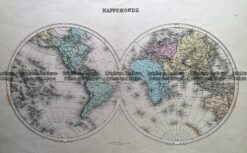
Antique Map 232-132  Mappemonde by Migeon  c.1892

Antique Map 232-132 Mappemonde by Migeon c.1892

$175.00
2-163  World in ancient times by Wilkinson c.1830

Antique Map 2-163 World in ancient times by Wilkinson c.1830

$150.00
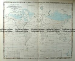
Antique Map 232-572  World - Isothermal Lines by Johnston  c.1850

Antique Map 232-572 World – Isothermal Lines by Johnston c.1850

$180.00
© 2026 BRIGHTON ANTIQUE PRINTS AND MAPS. ALL RIGHTS RESERVED | Website by Blaze Online Credit Card
Visa
PayPal
Stripe
MasterCard
Cash On Delivery
  • Home
  • Catalogue
    • Antique Maps
    • Antique Prints
    • Books & Gov’t Reports
    • Manuscript Documents
  • Recent Arrivals
  • About
  • FAQ
  • Register Interests
  • Contact Us
  • View Cart

Sending...