Skip to content
Brighton Antique Prints and MapsBrighton Antique Prints and Maps
  • CURRENCY

    WOOCS 2.1.5
  • VIEW CART
  • Catalogue
  • Home
  • Catalogue
    • Antique Maps
    • Antique Prints
    • Books & Gov’t Reports
    • Manuscript Documents
  • Recent Arrivals
  • About
  • FAQ
  • Register Interests
  • Contact Us
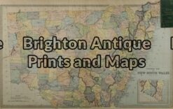
9-073 - New South Wales J Bartholomew - circa 1848 Hand coloured steel engraving 27cm X 38cm Condition A+
Home / Antique Maps / Australia & Pacific / NSW
  • 2-157  Tallis map of Indonesia and S. E. Asia

Antique Map 9-073 – New South Wales J Bartholomew – circa 1848 Hand coloured steel engraving 27cm X 38cm Condition A+

  • 2-157  Tallis map of Indonesia and S. E. Asia

$190.00

SKU: 9-073 Categories: Antique Maps, NSW
  • 2-157  Tallis map of Indonesia and S. E. Asia
Product Categories
  • Antique Maps
    • World
    • Australia & Pacific
      • Australia - Continent
      • Victoria
      • Victorian Parish & Military Maps
      • Victorian Geological Maps
      • Melbourne
      • NSW
      • Tasmania
      • Queensland
      • WA, SA & NT
      • New Zealand
      • Pacific
    • Britain and Ireland
    • Europe
    • Asia
    • North America
    • South America
    • Africa
    • City Street Maps
    • Geological maps
    • Tallis
  • Antique Prints
  • Books & Gov't Reports
  • Manuscript Documents
  • Description

New South Wales

J Bartholomew – circa 1848
Hand coloured steel engraving
27cm X 38cm
Condition A+

These may also be of interest

9-066 - Botany Bay / Endeavour River J Cook - circa 1774 Copperplate engraving 33cm X 13cm Condition A+

Antique Map 9-066 – Botany Bay / Endeavour River J Cook – circa 1774 Copperplate engraving 33cm X 13cm Condition A+

$950.00
9-070 - New South Wales Picturesque Atlas - circa 1886 Chromolithograph 62cm X 38cm Condition A+

Antique Map 9-070 – New South Wales Picturesque Atlas – circa 1886 Chromolithograph 62cm X 38cm Condition A+

$175.00
Antique Map 232-570  NSW - Geological map of County of Camden  c.1920

Antique Map 232-570 NSW – Geological map of County of Camden c.1920

$125.00
9-069 - New South Wales Benarba

Antique Map 9-069 – New South Wales Benarba, Stapylton, Courallie, etc J Sands – circa 1886 Chromolithograph 42cm X 53cm Condition A+

$190.00
© 2026 BRIGHTON ANTIQUE PRINTS AND MAPS. ALL RIGHTS RESERVED | Website by Blaze Online Credit Card
Visa
PayPal
Stripe
MasterCard
Cash On Delivery
  • Home
  • Catalogue
    • Antique Maps
    • Antique Prints
    • Books & Gov’t Reports
    • Manuscript Documents
  • Recent Arrivals
  • About
  • FAQ
  • Register Interests
  • Contact Us
  • View Cart

Sending...