Brighton Antique Prints and Maps
Currency
WOOCS 2.1.5
VIEW CART
  • CURRENCY

    WOOCS 2.1.5
  • Home
  • Catalogue
    • Antique Maps
    • Antique Prints
    • Books & Gov’t Reports
    • Manuscript Documents
  • Recent Arrivals
  • About
  • FAQ
  • Register Interests
  • Contact Us

Home/Antique Maps/Europe/Europe - Continent

Showing all 25 results

Filter
  • Antique Maps

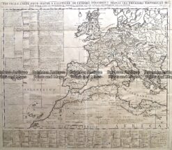
    Antique Map 232-174 Europe in Roman times by Chatelain c.1719

    $350.00
  • Antique Maps

    Antique Map 232-070 Europe by Bowen c.1744

    $325.00
  • Antique Maps

    Antique Map 232-148 L’Empire Romain by D’Anville c.1797

    $190.00
  • Europe - Continent

    Antique Map – Ancient Roman Empire by Teasdale c.1847 Ref: 237-125

    $180.00
  • Antique Maps

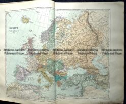
    Antique Map 5-070 Europe by Teasdale c.1847

    $180.00
  • 5-027 - Europe at Napoleonic era W & AK Johnston - circa 1886 Chromolithograph 43cm X 30cm Condition A+
    Europe - Continent

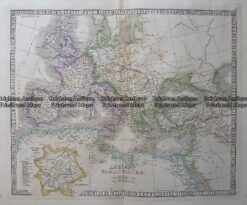
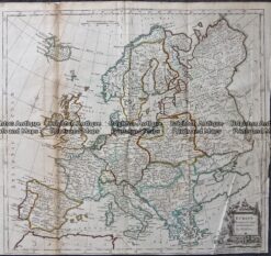
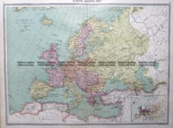
    5-027 – Europe at Napoleonic era W & AK Johnston – circa 1886 Chromolithograph 43cm X 30cm Condition A+

    $160.00
  • Antique Maps

    Antique Map 232-401 Europe by Cruchley c.1834

    $150.00
  • 4-182 Europe by S.D.U.K. c.1844
    Antique Maps

    Antique Map 4-182 Europe by S.D.U.K. c.1844

    $150.00
  • 5-024 - Europe - ethnographic map W & AK Johnston - circa 1860 Hand coloured steel engraving 59cm X 49cm Condition B
    Antique Maps

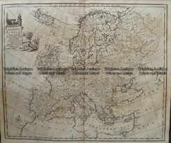
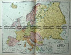
    Antique Map 5-024 – Europe – ethnographic map W & AK Johnston – circa 1860 Hand coloured steel engraving 59cm X 49cm Condition B

    $150.00
  • Europe - Continent

    Antique Map – Europe by Kitchin c.1780

    $125.00
  • Antique Maps

    Antique Map 233-219 Europe by Rand McNally c.1894

    $125.00
  • Antique Maps

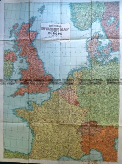
    Antique Map 230-197 Europe – World War II invasion map c.1940’s

    $125.00
  • Antique Maps

    Antique Map 233-287 Europe by Stanford c.1887

    $100.00
  • 4-193  Europe in Ancient Times by Wilkinson c.1830
    Antique Maps

    Antique Map 4-193 Europe in Ancient Times by Wilkinson c.1830

    $100.00
  • 4-186  Europe - Topographical map  by Blackwood  c.1890
    Antique Maps

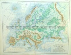
    Antique Map 4-186 Europe – Topographical map by Blackwood c.1890

    $90.00
  • 5-029 - Europe - at the times of Charles V Jenotte - circa 1830 Hand coloured steel engraving 43cm X 29cm Condition A+
    Antique Maps

    Antique Map 5-029 – Europe – at the times of Charles V Jenotte – circa 1830 Hand coloured steel engraving 43cm X 29cm Condition A+

    $90.00
  • Europe - Continent

    Antique map – Europe by Halmsworth c.1905 Ref: 260-001

    $75.00
  • SOLD
    Antique Maps

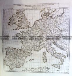
    Antique Map 230-142 Europe – Germany, France Spain & Britain c.1785

  • SOLD
    Antique Maps

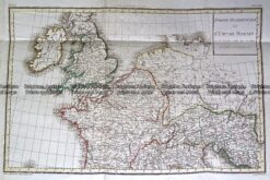
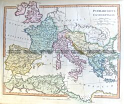
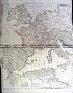
    Antique Map 230-131 Europe – Orbis Romani Pars Occidentalis by D’Anville c.1785

  • SOLD
    Antique Maps

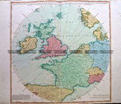
    Antique Map 230-127 Accurate map of Great Britain, France . . . by Laurie & Whittle c.1794

  • SOLD
    Antique Maps

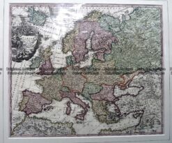
    Antique Map 230-213 Europa by Homann c.1720

  • SOLD
    Antique Maps

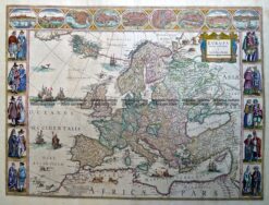
    Antique Map 230-125 Europa Resens Descripta by Blaeu c.1635 (1662)

  • 4-187  Europe Geological by Blackwood  c.1890
    SOLD
    Antique Maps

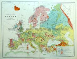
    Antique Map 4-187 Europe Geological by Blackwood c.1890

  • 5-030 - Mediterranean Sea Thomson - circa 1817 Outline colour engraving 60cm X 49cm Condition B+
    SOLD
    Antique Maps

    Antique Map 5-030 – Mediterranean Sea Thomson – circa 1817 Outline colour engraving 60cm X 49cm Condition B+

  • 5-026 - Europe J Wyld - circa 1820 Hand coloured steel engraving 29cm X 22cm Condition A+
    SOLD
    Antique Maps

    Antique Map 5-026 – Europe J Wyld – circa 1820 Hand coloured steel engraving 29cm X 22cm Condition A+

Categories

  • Antique Maps
    • World
    • Australia & Pacific
    • Britain and Ireland
    • Europe
      • Europe - Continent
      • France
      • Germany
      • Italy
      • Greece
      • Holland & Belgium
      • Poland & Baltic
      • Balkans
      • Spain & Portugal
      • Scandinavia
      • Switzerland
      • Russia
      • Turkey
      • Other
    • Asia
    • North America
    • South America
    • Africa
    • City Street Maps
    • Geological maps
    • Tallis
  • Antique Prints
  • Books & Gov't Reports
  • Manuscript Documents

© 2025 BRIGHTON ANTIQUE PRINTS AND MAPS. ALL RIGHTS RESERVED | Website by Blaze Online
Credit Card
Norton Safe Web Transaction
  • Home
  • Catalogue
    • Antique Maps
    • Antique Prints
    • Books & Gov’t Reports
    • Manuscript Documents
  • Recent Arrivals
  • About
  • FAQ
  • Register Interests
  • Contact Us
  • View Cart
  • Login
  • Currency
    WOOCS 2.1.5