Brighton Antique Prints and Maps
Currency
WOOCS 2.1.5
VIEW CART
  • CURRENCY

    WOOCS 2.1.5
  • Home
  • Catalogue
    • Antique Maps
    • Antique Prints
    • Books & Gov’t Reports
    • Manuscript Documents
  • Recent Arrivals
  • About
  • FAQ
  • Register Interests
  • Contact Us

Home/Antique Maps/Europe/France

Showing all 44 results

Filter
  • Antique Maps

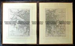
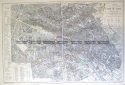
    Antique Map – Paris Street Map by S.D.U.K. c.1844 Ref: 889-031

    $550.00
  • Antique Maps

    Antique Map 233-011 Paris Street Map France by S.D.U.K. c.1844

    $390.00
  • Antique Maps

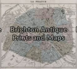
    Antique Map 230-191 Paris and vicinity by Levasseur c.1854

    $350.00
  • Antique Maps

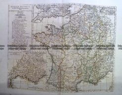
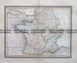
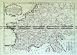
    Antique Map 230-133 France – Gallia Antiqua by D’Anville c.1785

    $290.00
  • Antique Maps

    Antique Map 230-505 French Riviera by Schreibern c.1740

    $275.00
  • Antique Maps

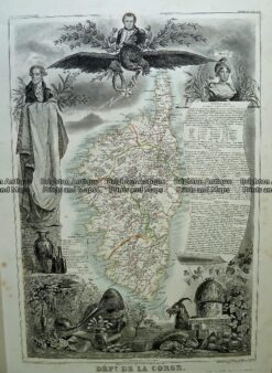
    Antique Map 230-195 Corsica by Levasseur c.1854

    $275.00
  • Antique Maps

    Antique Map 232-170 Carte de la Republique Française by Chanlaire c.1780

    $250.00
  • Antique Maps

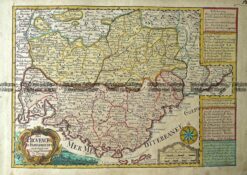
    Antique Map 230-825 Provence in France by Schreibern c.1740

    $250.00
  • 5-258  France - South West by Zatta  c.1776
    Antique Maps

    Antique Map 5-258 France – South West by Zatta c.1776

    $250.00
  • Antique Maps

    Antique Map

    $225.00
  • 5-255  Paris street map  c.1949
    Antique Maps

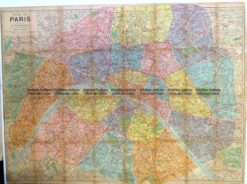
    Antique Map 5-255 Paris street map c.1949

    $225.00
  • 5-068  France by Teasdale  c.1844
    Antique Maps

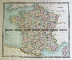
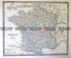
    Antique Map 5-068 France by Teasdale c.1847

    $180.00
  • Antique Maps

    Antique Map 230-186 Paris c.1880

    $175.00
  • Antique Maps

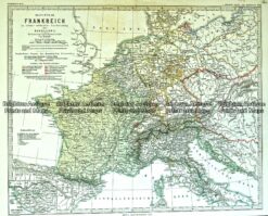
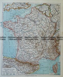
    Antique Map 233-404 Frankreich unter Napoleon

    $160.00
  • Antique Maps

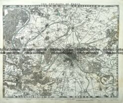
    Antique Map 233-010 Paris and Environs by S.D.U.K. c.1844

    $160.00
  • 5-038 - Paris - Street Map Anon - circa 1850 Steel engraving 28cm X 22cm Condition A+
    Antique Maps

    Antique Map 5-038 – Paris – Street Map Anon – circa 1850 Steel engraving 28cm X 22cm Condition A+

    $160.00
  • Antique Maps

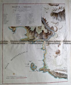
    Antique Map 232-135 Pianta di Tolone c.1824

    $150.00
  • Antique Maps

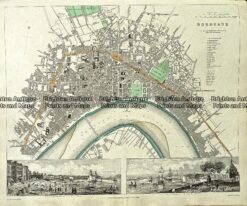
    Antique Map 233-001 Bordeaux Street Map France by S.D.U.K. c.1844

    $140.00
  • 5-159 France by Colton  circa 1855
    Antique Maps

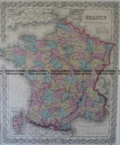
    Antique Map 5-159 France by Colton circa 1855

    $140.00
  • Antique Maps

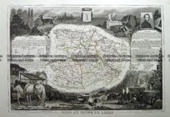
    Antique Map 230-195 Loire Valley area south of Paris by Levasseur c.1854

    $125.00
  • 5-039 - France - Charente A Vuillemin - circa 1860 Hand coloured steel engraving 22cm X 18cm Condition A+
    Antique Maps

    Antique Map 5-039 – France – Charente A Vuillemin – circa 1860 Hand coloured steel engraving 22cm X 18cm Condition A+

    $125.00
  • Antique Maps

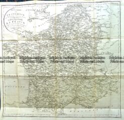
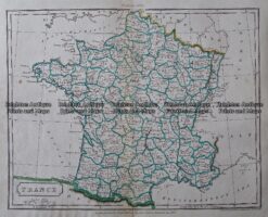
    Antique Map 233-405 France in Departments by Wyld c.1840

    $120.00
  • Antique Maps

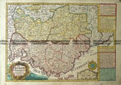
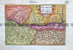
    Antique Map 232-164 Alsatia (north east France) c.1609

    $120.00
  • Antique Maps

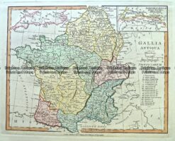
    Antique Map 233-406 Gallia Antique by Wilkinson c.1815

    $110.00
  • France

    Antique Map – Gallia Antiqua c.1800 Ref: 237-341

    $95.00
  • Antique Maps

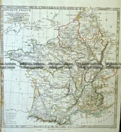
    Antique Map 233-407 France by Arrowsmith c.1807

    $75.00
  • Antique Maps

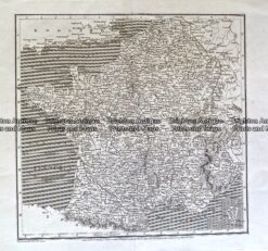
    Antique Map 233-403 Ancient France or Gallia by S.D.U.K. c.1844

    $75.00
  • Antique Maps

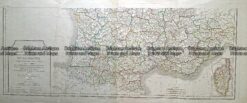
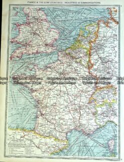
    Antique Map 233-400 France – industries & communications by Philip c.1905

    $75.00
  • Antique Maps

    Antique Map 233-402 Frankreich by Bibliographisches Institut c.1880

    $65.00
  • Antique Maps

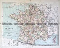
    Antique Map 233-408 France in Departments by Philip c.1870

    $60.00
  • Antique Maps

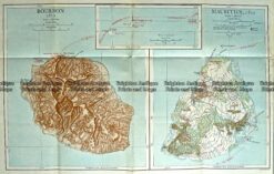
    Antique Map 236-010 Bourbon and Mauritius in 1810, published c.1910

    $60.00
  • France

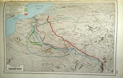
    Antique map – Western Front c.1920. Ref: 232-709

    $50.00
  • France

    Antique map – Western Front c.1920. Ref: 232-706

    $50.00
  • Antique Maps

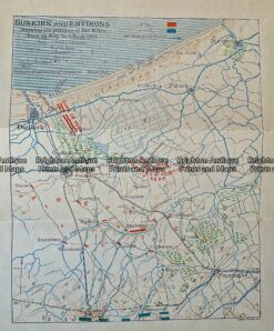
    Antique Print Antique Map 236 – 008 Dunkirk and environs in 1793, published c.1910

    $50.00
  • Antique Maps

    Antique Map 232-106 Navigation Charts corrected to 1940’s

    $50.00
  • France

    Antique Map – France by Walker c.1805 Ref: 237-347

    $45.00
  • SOLD
    Antique Maps

    Antique Map 233-401 Carte de France by Nolin c.1760

  • SOLD
    Antique Maps

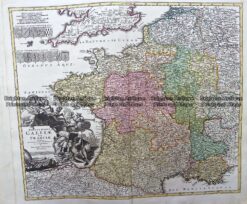
    Antique Map 230-215 Galliae by Homann c.1720

  • SOLD
    Antique Maps

    Antique Map 230-212 Paris street map c.1817

  • SOLD
    Antique Maps

    Antique Map 230-194 Loire Valley area south of Paris by Levasseur c.1854

  • SOLD
    Antique Maps

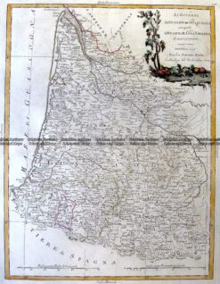
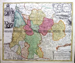
    Antique Map 230-128 Tabula Aquitaine by Homann c.1720

  • 5-201  Panorama of Paris  c.1874
    SOLD
    Antique Maps

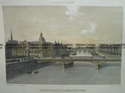
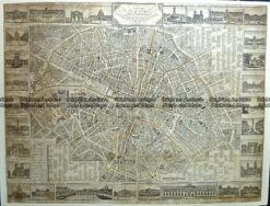
    Antique Map 5-201 Panorama of Paris c.1874

  • 5-256  Paris street map by Letts  c.1883
    SOLD
    Antique Maps

    Antique Map 5-256 Paris street map by Letts c.1883

  • 5-058 - France S Hall - circa 1860 Steel engraving 38cm X 26cm Condition A+
    SOLD
    Antique Maps

    Antique Map 5-058 – France S Hall – circa 1860 Steel engraving 38cm X 26cm Condition A+

Categories

  • Antique Maps
    • World
    • Australia & Pacific
    • Britain and Ireland
    • Europe
      • Europe - Continent
      • France
      • Germany
      • Italy
      • Greece
      • Holland & Belgium
      • Poland & Baltic
      • Balkans
      • Spain & Portugal
      • Scandinavia
      • Switzerland
      • Russia
      • Turkey
      • Other
    • Asia
    • North America
    • South America
    • Africa
    • City Street Maps
    • Geological maps
    • Tallis
  • Antique Prints
  • Books & Gov't Reports
  • Manuscript Documents

© 2025 BRIGHTON ANTIQUE PRINTS AND MAPS. ALL RIGHTS RESERVED | Website by Blaze Online
Credit Card
Norton Safe Web Transaction
  • Home
  • Catalogue
    • Antique Maps
    • Antique Prints
    • Books & Gov’t Reports
    • Manuscript Documents
  • Recent Arrivals
  • About
  • FAQ
  • Register Interests
  • Contact Us
  • View Cart
  • Login
  • Currency
    WOOCS 2.1.5