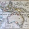
Brighton Antique Prints and Maps
Currency
WOOCS 2.1.5
VIEW CART
  • CURRENCY

    WOOCS 2.1.5
  • Home
  • Catalogue
    • Antique Maps
    • Antique Prints
    • Books & Gov’t Reports
    • Manuscript Documents
  • Recent Arrivals
  • About
  • FAQ
  • Register Interests
  • Contact Us
14-203 – Victoria Picturesque Atlas – circa 1886 Chromolithograph 61cm C 37cm Condition A+

Home/Antique Maps/Australia & Pacific/Victoria

Antique Map 14-203 – Victoria Picturesque Atlas – circa 1886 Chromolithograph 61cm C 37cm Condition A+

SKU: 14-203 Categories: Antique Maps, Victoria
3-863  Australia circa 1849
5-055  North & South America by Teasdale  c.1844
  • Description

Victoria

Picturesque Atlas – circa 1886
Chromolithograph
61cm C 37cm
Condition A+


These may also be of interest

  • 3-830  Doutta Galla in County of Bourke  c.1969
    Antique Maps

    Antique Map 3-830 Doutta Galla in County of Bourke c.1969

    $125.00
  • Victoria

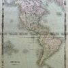
    Antique map – Gold fields in South Australia c.1853Ref: 339-009

    $1,700.00
  • Victoria

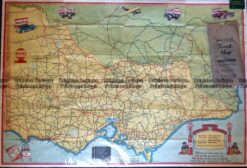
    Antique Map – Road Map of Victoria by Vacuum Oil Co. c.1930’s Ref No. 238-005

    $89.00
  • 14-217 - Victoria - County of Tanjil John Sands - circa 1886 Chromolithograph 52cm X 42cm Condition A+
    Antique Maps

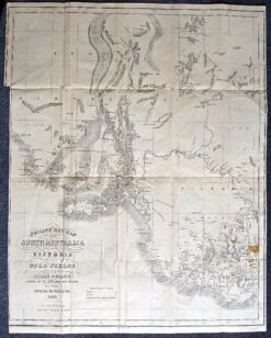
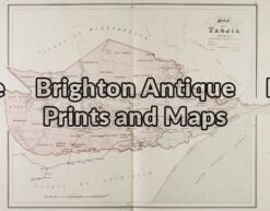
    Antique Map 14-217 – Victoria – County of Tanjil John Sands – circa 1886 Chromolithograph 52cm X 42cm Condition A+

    $290.00
© 2026 BRIGHTON ANTIQUE PRINTS AND MAPS. ALL RIGHTS RESERVED | Website by Blaze Online
Credit Card
Norton Safe Web Transaction
  • Home
  • Catalogue
    • Antique Maps
    • Antique Prints
    • Books & Gov’t Reports
    • Manuscript Documents
  • Recent Arrivals
  • About
  • FAQ
  • Register Interests
  • Contact Us
  • View Cart
  • Login
  • Currency
    WOOCS 2.1.5

Sending...