CURRENCY
$160.00
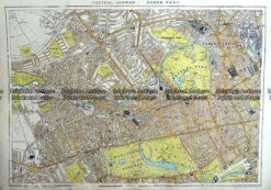
London and vicinity Street Map by S.D.U.K. c.1844
Steel engraving 37cm X 28cm Condition A+
There are no reviews yet.
You must be logged in to post a comment.
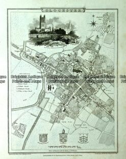
Antique map – Glocester Street Map by Verner, Hood & Sharpe c.1805 Ref#232-741
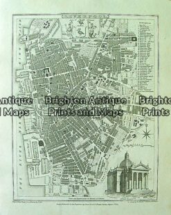
Antique Map 4-200 Liverpool street map by Moule c.1840
Antique Map 233-295 London – North West Central by Stanford c.1887
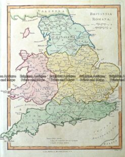
Antique Map 4-189 England in Roman times by Wilkinson c.1830


Reviews
There are no reviews yet.