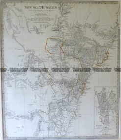
CURRENCY
Hand coloured lithograph 52cm X 38cm Condition A+
SOLD
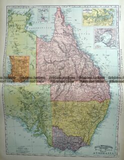
Antique Map 233-225 Australia – Victoria, NSW, Queensland by Rand McNally c.1894
Antique map – New South Wales c.1886 Ref: 889-003
Antique Map 9-800 New South Wales by S.D.U.K. c.1844
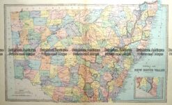
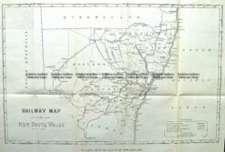
Antique Map 9-811 NSW Railway Map c.1884