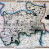
CURRENCY
NSW & Australia by Henry Teesdale c.1847 engraved by j. Dower
Hand coloured steel engraving 41cm X 34cm&; Condition A+
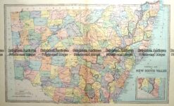
Antique map – New South Wales c.1886 Ref: 889-003
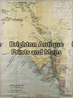
Antique Map 3-080 – South Australia Australian Handbook – circa 1885 Chromolithograph 38cm X 51cm Condition A
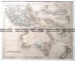
Antique Map – Australia & New Zealand by Betts c.1845 Ref: 237-360
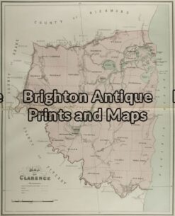
Antique Map 9-068 – New South Wales Clarence J Sands – circa 1886 Chromolithograph 42cm X 53cm Condition A+