CURRENCY
$240.00
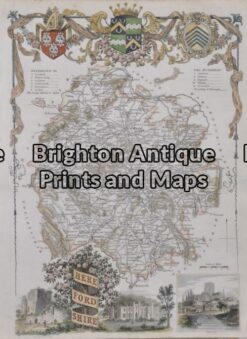
England – Herefordshire
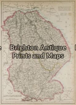
Antique Map 5-144 – England – Lincolnshire J Dower – circa 1850 Steel engraving 31cm X 43cm Condition A+
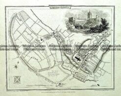
Antique map – St Alban’s Street Map by Verner, Hood & Sharpe c.1805 Ref#232-748
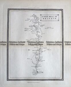
Antique Map – Roman Wall in Britain c.1800 Ref 237-334
Antique Map 5-164 – England – Herefordshire Hand coloured steel engraving 19cm X 26cm Condition A+