Brighton Antique Prints and Maps
Currency
WOOCS 2.1.5
VIEW CART
  • CURRENCY

    WOOCS 2.1.5
  • Home
  • Catalogue
    • Antique Maps
    • Antique Prints
    • Books & Gov’t Reports
    • Manuscript Documents
  • Recent Arrivals
  • About
  • FAQ
  • Register Interests
  • Contact Us

Home/Antique Maps/Europe/Holland & Belgium

Showing all 38 results

Filter
  • Holland & Belgium

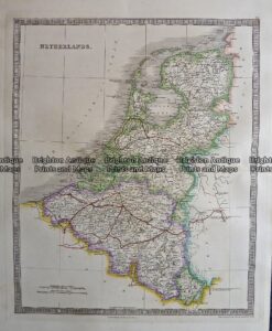
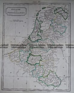
    Antique map – Netherlands by Teasdale c.1847 Ref: 237-120

    $240.00
  • 5-160  Belgium by Johnston  c.1857
    Antique Maps

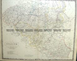
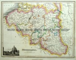
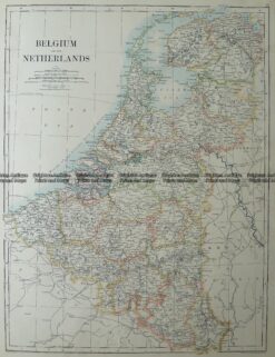
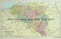
    Antique Map 5-160 Belgium by Johnston c.1857

    $220.00
  • 5-157  Holland by J Wyld  c.1840
    Antique Maps

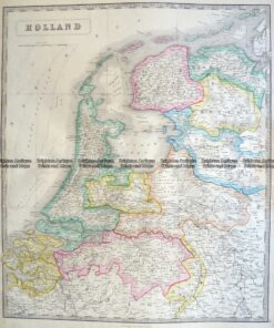
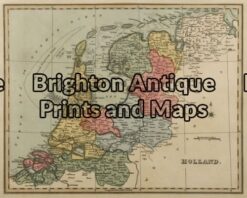
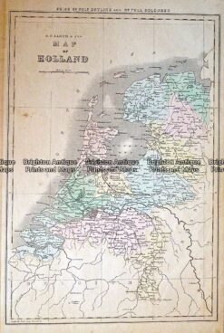
    Antique Map 5-157 Holland by J Wyld c.1840

    $220.00
  • 5-042 - Belgium J Tallis - circa 1851
    Antique Maps

    Antique Map 5-042 – Belgium J Tallis – circa 1851

    $220.00
  • 5-171  Holland and Belgium by J Wyld  c.1853
    Antique Maps

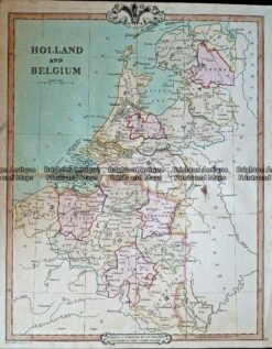
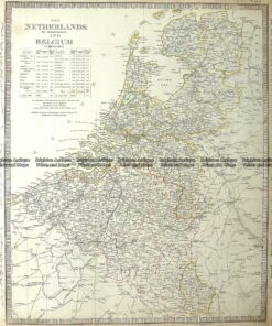
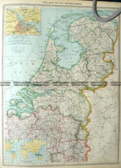
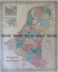
    Antique Map 5-171 Holland and Belgium by J Wyld c.1853

    $180.00
  • 5-170  Holland or The Netherlands  by Thomson  c.1820
    Antique Maps

    Antique Map 5-170 Holland or The Netherlands by Thomson c.1820

    $180.00
  • 5-161 Belgium and the Netherlands by Johnston  c.1887
    Antique Maps

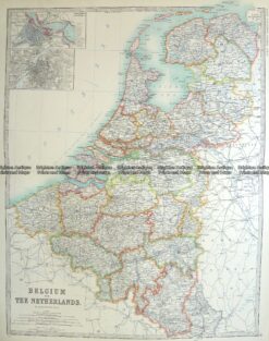
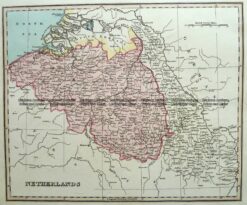
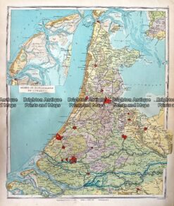
    Antique Map 5-161 Belgium and the Netherlands by Johnston c.1887

    $180.00
  • 5-156  Holland Seven United Provinces by Bowen  c.1800
    Antique Maps

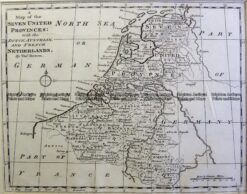
    Antique Map 5-156 Holland Seven United Provinces by Bowen c.1800

    $180.00
  • 5-169  Holland or United Provinces by Gibson  c.1771
    Antique Maps

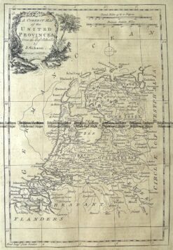
    Antique Map 5-169 Holland or United Provinces by Gibson c.1771

    $175.00
  • Antique Maps

    Antique Map 232-408 Holland & Belgium by Cruchley c.1834

    $150.00
  • 5-164  Netherlands or Holland  c.1800
    Antique Maps

    Antique Map 5-164 Netherlands or Holland c.1800

    $150.00
  • 5-051 - Holland by J Wyld - circa 1820
    Antique Maps

    Antique Map 5-051 – Holland by J Wyld – circa 1820

    $150.00
  • Antique Maps

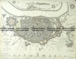
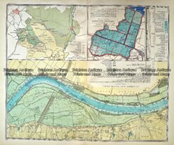
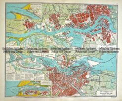
    Antique Map 233-000 Antwerp Holland street map by S.D.U.K. c.1844

    $140.00
  • 5-168  Belgium and The Netherlands by Johnston  c.1886
    Antique Maps

    Antique Map 5-168 Belgium and The Netherlands by Johnston c.1886

    $140.00
  • 5-167  The Netherlands or Holland and Belgium by S.D.U.K  c.1844
    Antique Maps

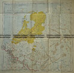
    Antique Map 5-167 The Netherlands or Holland and Belgium by S.D.U.K c.1844

    $140.00
  • 5-163  Netherlands or Holland by S.D.U.K.  c.1830
    Antique Maps

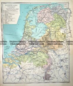
    Antique Map 5-163 Netherlands or Holland by S.D.U.K. c.1830

    $140.00
  • 5-155  Holland Niederlande  c.1887
    Antique Maps

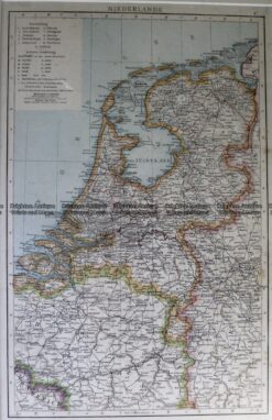
    Antique Map 5-155 Holland Niederlande c.1887

    $110.00
  • Antique Maps

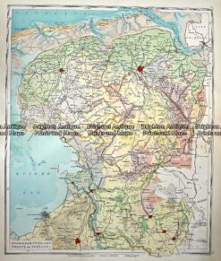
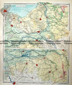
    Antique Map 233-346 Holland – Groningen, Friesland, Drente en Overijsel by Wolters c.1929

    $100.00
  • Antique Maps

    Antique Map 233- 340 Holland – Oosterbeek by Wolters c.1929

    $100.00
  • 5-162  The Netherlands Belgium & Luxemburg  by Rand McNally  c.1890
    Antique Maps

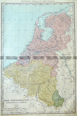
    Antique Map 5-162 The Netherlands Belgium & Luxemburg by Rand McNally c.1890

    $100.00
  • 5-165  Holland or The Netherlands by Halmsworth  c.1905
    Antique Maps

    Antique Map 5-165 Holland or The Netherlands by Halmsworth c.1905

    $85.00
  • Antique Maps

    Antique Map 233-344 Holland – Gelderland and Noord Brabant by Wolters c.1929

    $80.00
  • Antique Maps

    Antique Map 233-343 Holland – noord en Zuid en Utrecht by Wolters c.1929

    $80.00
  • Antique Maps

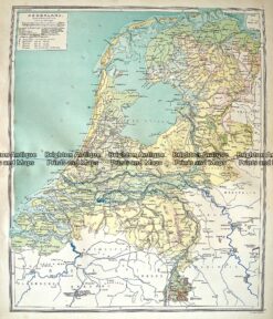
    Antique Map 233-342 Holland by Wolters c.1929

    $80.00
  • Antique Maps

    Antique Map 233-341 Holland – Hoogtekaart by Wolters c.1929

    $80.00
  • Antique Maps

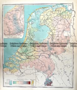
    Antique Map 233-338 Nederland grondsoorten c.1929

    $80.00
  • Antique Maps

    Antique Print Antique Map 236-002 Holland, Prussia and Belgium, published c.1910

    $75.00
  • 5-158  Holland and Belgium by Chambers  c.1860
    Antique Maps

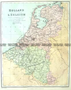
    Antique Map 5-158 Holland and Belgium by Chambers c.1860

    $75.00
  • Holland & Belgium

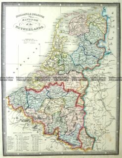
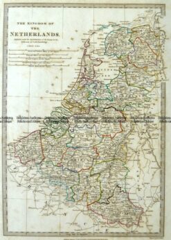
    Antique Map – Kingdom of the Netherlands by Walker c.1805 Ref: 237-349

    $55.00
  • 5-159  Belgium by Chambers  c.1880
    Antique Maps

    Antique Map 5-159 Belgium by Chambers c.1880

    $45.00
  • SOLD
    Antique Maps

    Antique Map 233-339 Holland – Amsterdam and Rotterdam by Wolters c.1929

  • SOLD
    Antique Maps

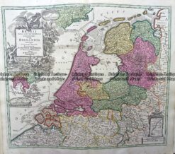
    Antique Map 230-504 Holland by Schreibern c.1740

  • SOLD
    Antique Maps

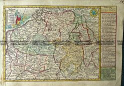
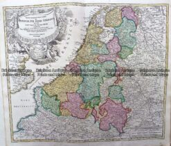
    Antique Map 230-216 Holland and Belgium by Homann c.1720

  • SOLD
    Antique Maps

    Antique Map 232-427 Holland by Lloyd c.1848

  • SOLD
    Antique Maps

    Antique Map 230-217 Hollandia by Homann c.1720

  • 5-172  Oost Zee by van Loon/Jansson  c.1655
    SOLD
    Antique Maps

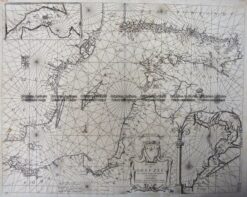
    Antique Map 5-172 Oost Zee by van Loon/Jansson c.1655

  • 5-154 - Holland Anon - circa 1800
    SOLD
    Antique Maps

    Antique Map 5-154 – Holland Anon – circa 1800

  • 5-166 Holland and Belgium by Colton  circa 1855
    SOLD
    Antique Maps

    Antique Map 5-166 Holland and Belgium by Colton circa 1855

Categories

  • Antique Maps
    • World
    • Australia & Pacific
    • Britain and Ireland
    • Europe
      • Europe - Continent
      • France
      • Germany
      • Italy
      • Greece
      • Holland & Belgium
      • Poland & Baltic
      • Balkans
      • Spain & Portugal
      • Scandinavia
      • Switzerland
      • Russia
      • Turkey
      • Other
    • Asia
    • North America
    • South America
    • Africa
    • City Street Maps
    • Geological maps
    • Tallis
  • Antique Prints
  • Books & Gov't Reports
  • Manuscript Documents

© 2025 BRIGHTON ANTIQUE PRINTS AND MAPS. ALL RIGHTS RESERVED | Website by Blaze Online
Credit Card
Norton Safe Web Transaction
  • Home
  • Catalogue
    • Antique Maps
    • Antique Prints
    • Books & Gov’t Reports
    • Manuscript Documents
  • Recent Arrivals
  • About
  • FAQ
  • Register Interests
  • Contact Us
  • View Cart
  • Login
  • Currency
    WOOCS 2.1.5