
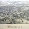
Sydney street map of Canterbury, Kogarah, Hurstville Rockdale area c.1954
47cm X 79cm
Condition A
Others available

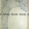
Sydney street map of Canterbury, Kogarah, Hurstville Rockdale area c.1954
47cm X 79cm
Condition A
Others available
You must be logged in to post a comment.

Reviews
There are no reviews yet.