CURRENCY
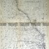
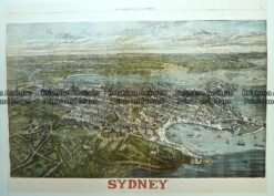
Sydney and vicinity with plan of CBD by Gordon & Gotch c.1889
Lithograph 36cm X 48cm Condition A+
There are no reviews yet.
You must be logged in to post a comment.
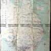
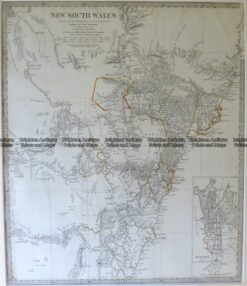
Antique Map 9-800 New South Wales by S.D.U.K. c.1844
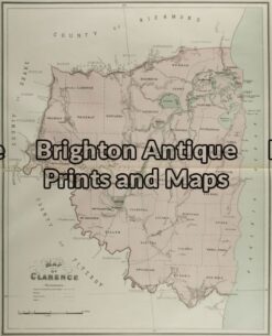
Antique Map 9-068 – New South Wales Clarence J Sands – circa 1886 Chromolithograph 42cm X 53cm Condition A+
Antique Map 9-066 – Botany Bay / Endeavour River J Cook – circa 1774 Copperplate engraving 33cm X 13cm Condition A+
Antique Print Antique Map 231-001 Bird’s eye panorama of Sydney as it was in 1880


Reviews
There are no reviews yet.