Brighton Antique Prints and Maps
Currency
WOOCS 2.1.5
VIEW CART
  • CURRENCY

    WOOCS 2.1.5
  • Home
  • Catalogue
    • Antique Maps
    • Antique Prints
    • Books & Gov’t Reports
    • Manuscript Documents
  • Recent Arrivals
  • About
  • FAQ
  • Register Interests
  • Contact Us

Home/Antique Maps/Britain and Ireland/Britain

Showing all 79 results

Filter
  • Britain

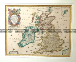
    Antique map – Britain by Sanson c.1669 Ref: 889-005

    $990.00
  • 4-174  England and Wales by Chatelain c.1719
    Antique Maps

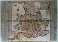
    Antique Map 4-174 England and Wales by Chatelain c.1719

    $625.00
  • Antique Maps

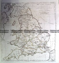
    Antique Map 230-139 Britain – Britanniae Antiquae by D’Anville c.1785

    $350.00
  • 4-175 Ireland by S.D.U.K. c.1944
    Antique Maps

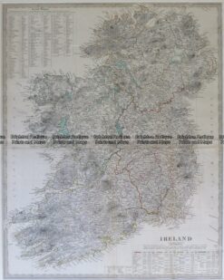
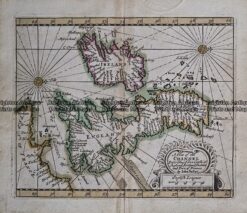
    Antique Map 4-175 Ireland by S.D.U.K. c.1844

    $350.00
  • 4-183  England and Wales by Robert c.1753
    Antique Maps

    Antique Map 4-183 England and Wales by Robert c.1753

    $325.00
  • 4-033 - England and Wales A & C Black - circa 1865 Chromolithograph 56cm X 42cm Condition A+
    Antique Maps

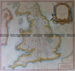
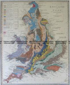
    Antique Map 4-033 – England and Wales A & C Black – circa 1865 Chromolithograph 56cm X 42cm Condition A+

    $250.00
  • 4-194  Cambridgeshire by I. Slater c.1847
    Antique Maps

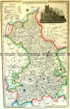
    Antique Map 4-194 Cambridgeshire by I. Slater c.1846

    $240.00
  • 4-193  Oxfordshire England by I. Slater c.1847
    Antique Maps

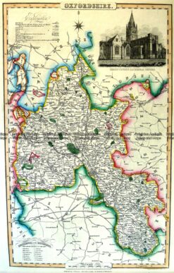
    Antique Map 4-193 Oxfordshire England by I. Slater c.1846

    $240.00
  • 4-164 - England - Northamptonshire Moule - circa 1840 Hand coloured steel engraving 19cm X 26cm Condition A+
    Antique Maps

    Antique Map 4-164 – England – Northamptonshire Moule – circa 1840 Hand coloured steel engraving 19cm X 26cm Condition A+

    $240.00
  • 4-158 - England - Isle of Man Moule - circa 1840 Hand coloured steel engraving 26cm X 19cm Condition A+
    Antique Maps

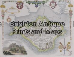
    Antique Map 4-158 – England – Isle of Man Moule – circa 1840 Hand coloured steel engraving 26cm X 19cm Condition A+

    $240.00
  • 4-146 - England - Hampshire Moule - circa 1840 Hand coloured steel engraving 21cm X 26cm Condition A+
    Antique Maps

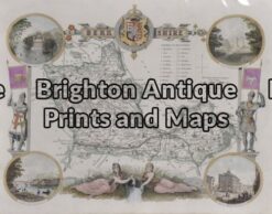
    Antique Map 4-146 – England – Hampshire Moule – circa 1840 Hand coloured steel engraving 21cm X 26cm Condition A+

    $240.00
  • 4-162 - England - Lincolnshire Moule - circa 1840 Hand coloured steel engraving 19cm X 26cm Condition A+
    Antique Maps

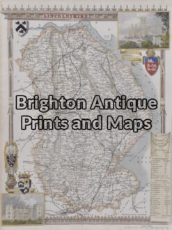
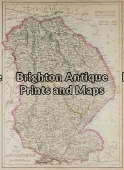
    Antique Map 4-162 – England – Lincolnshire Moule – circa 1840 Hand coloured steel engraving 19cm X 26cm Condition A+

    $240.00
  • 4-160 - England - Isle of Wight Moule - circa 1840 Hand coloured steel engravng 26cm X 19cm Condition A+
    Antique Maps

    Antique Map 4-160 – England – Isle of Wight Moule – circa 1840 Hand coloured steel engravng 26cm X 19cm Condition A+

    $240.00
  • 4-159 - England - Isle of Thanet Moule - circa 1840 Hand coloured steel engraving 26cm X 19cm Condition A+
    Antique Maps

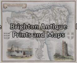
    Antique Map 4-159 – England – Isle of Thanet Moule – circa 1840 Hand coloured steel engraving 26cm X 19cm Condition A+

    $240.00
  • 4-147 - England - Hertfordshire Moule - circa 1840 Hand coloured steel engraving 25cm X 19cm
    Antique Maps

    Antique Map 4-147 – England – Hertfordshire Moule – circa 1840 Hand coloured steel engraving 25cm X 19cm

    $240.00
  • 4-157 - England - Herefordshire Moule - circa 1840 Hand coloured steel engraving Condition A+
    Antique Maps

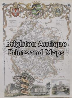
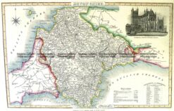
    Antique Map 4-157 – England – Herefordshire Moule – circa 1840 Hand coloured steel engraving Condition A+

    $240.00
  • 4-155 - England - Cumberland Moule - circa 1840 Hand coloured steel engraving 19cm X 26cm Condition A+
    Antique Maps

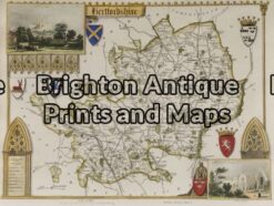
    Antique Map 4-155 – England – Cumberland Moule – circa 1840 Hand coloured steel engraving 19cm X 26cm Condition A+

    $240.00
  • 4-154 - England - Berkshire Moule - circa 1840 Hand coloured steel engraving Condition A+
    Antique Maps

    Antique Map 4-154 – England – Berkshire Moule – circa 1840 Hand coloured steel engraving Condition A+

    $240.00
  • Britain

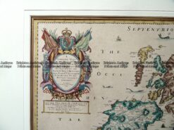
    Antique map – Britain by LeSage c.1829. Ref: 789-025

    $215.00
  • 5-136 - Britain Downer - circa 1850 Hand coloured steel engraving 21cm X 26cm Condition A+
    Antique Maps

    Antique Map 5-136 – Britain Downer – circa 1850 Hand coloured steel engraving 21cm X 26cm Condition A+

    $200.00
  • 4-136 - Britain Hand coloured steel engraving Downer - circa 1850 21cm X 26cm Condition A+
    Antique Maps

    Antique Map 4-136 – Britain Hand coloured steel engraving Downer – circa 1850 21cm X 26cm Condition A+

    $200.00
  • 4-195 Sussex England by I. Slater c.1847
    Antique Maps

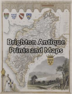
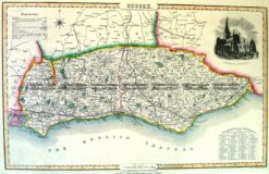
    Antique Map 4-195 Sussex England by I. Slater c.1846

    $195.00
  • 4-191  Shropshire England by I. Slater c.1847
    Antique Maps

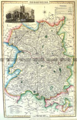
    Antique Map 4-191 Shropshire England by I. Slater c.1846

    $195.00
  • 4-189  Devonshire England by I. Slater c.1847
    Antique Maps

    Antique Map 4-189 Devonshire England by I. Slater c.1846

    $195.00
  • 4-188 Somersethire England by I. Slater c.1847
    Antique Maps

    Antique Map 4-188 Somersethire England by I. Slater c.1846

    $195.00
  • 4-187  Essex England by I. Slater c.1847
    Antique Maps

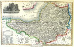
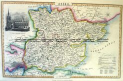
    Antique Map 4-187 Essex England by I. Slater c.1846

    $195.00
  • 4-186 County of Suffolk England c.1847
    Antique Maps

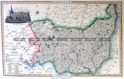
    Antique Map 4-186 County of Suffolk England c.1846

    $195.00
  • 4-192  Gloucestershire by I. Slater c.1847
    Antique Maps

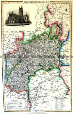
    Antique Map 4-192 Gloucestershire by I. Slater c.1846

    $195.00
  • Antique Maps

    Antique Map 232-148 L’Empire Romain by D’Anville c.1797

    $190.00
  • 4-177  London and vicinity by S.D.U.K. c.1844
    Antique Maps

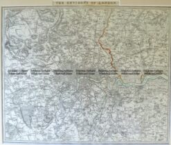
    Antique Map 4-177 London and vicinity by S.D.U.K. c.1844

    $190.00
  • Antique Maps

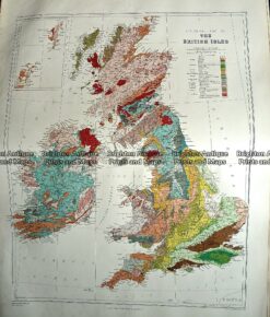
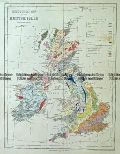
    Antique Map 233-288 Britain – Geological by Stanford c.1887

    $180.00
  • 4-181 Britain by S.D.U.K. c.1844
    Antique Maps

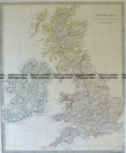
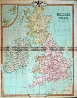
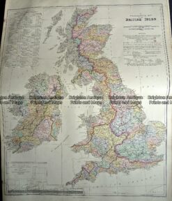
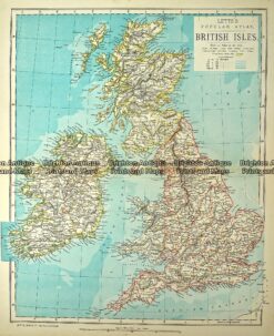
    Antique Map 4-181 Britain by S.D.U.K. c.1844

    $180.00
  • 5-135 - Britain Arrowsmith - circa 1809 Steel engraving 25cm X 40cm Condition A+
    Antique Maps

    Antique Map 5-135 – Britain Arrowsmith – circa 1809 Steel engraving 25cm X 40cm Condition A+

    $175.00
  • Antique Maps

    Antique Map 232-402 Britain by Cruchley c.1834

    $170.00
  • 4-169  Scotland  c.1844
    Antique Maps

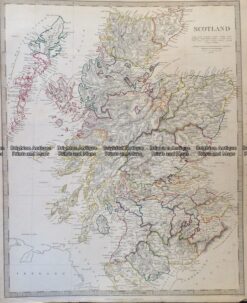
    Antique Map 4-169 Scotland c.1844

    $160.00
  • 4-185  Dublin panorama  c.1874
    Antique Maps

    Antique Map 4-185 Dublin panorama c.1874

    $160.00
  • 5-138 - Britain - Ethnological Map Johnston - circa 1886 Chromolithograph 33cm X 43cm Condition A
    Antique Maps

    Antique Map 5-138 – Britain – Ethnological Map Johnston – circa 1886 Chromolithograph 33cm X 43cm Condition A

    $160.00
  • 4-138 - Britain - ethnological map Johnston - circa 1886 Chromolithograph 33cm X 43cm Condition A
    Antique Maps

    Antique Map 4-138 – Britain – ethnological map Johnston – circa 1886 Chromolithograph 33cm X 43cm Condition A

    $160.00
  • 4-170  Ancient Scotland  c.1844
    Antique Maps

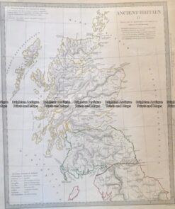
    Antique Map 4-170 Ancient Scotland c.1844

    $150.00
  • 4-167  Ancient England and Wales  c.1844
    Antique Maps

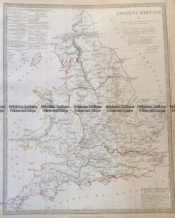
    Antique Map 4-167 Ancient England and Wales c.1844

    $150.00
  • 4-144 - England - Lincolnshire J Dower - circa 1850 Steel engraving 31cm X 43cm Condition A
    Antique Maps

    Antique Map 4-144 – England – Lincolnshire J Dower – circa 1850 Steel engraving 31cm X 43cm Condition A

    $150.00
  • Antique Maps

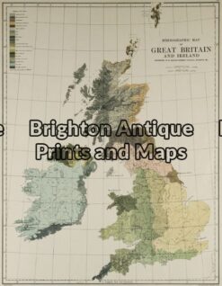
    Antique Map 233-306 Britain – Hydrographical by Stanford c.1879

    $140.00
  • Antique Maps

    Antique Map 233-290 Britain – Railway map by Stanford c.1887

    $140.00
  • Antique Maps

    Antique Map 233-289 Britain – County map by Stanford c.1887

    $140.00
  • 4-149 - Scotland - lowlands J & C Walker - circa 1835 Steel engraving 39cm X 32cm Condition A+
    Antique Maps

    Antique Map 4-149 – Scotland – lowlands J & C Walker – circa 1835 Steel engraving 39cm X 32cm Condition A+

    $140.00
  • 4-152 - Scotland - Highlands J & C Walker - circa 1835 Steel engraving 39cm X 32cm Condition A+
    Antique Maps

    Antique Map 4-152 – Scotland – Highlands J & C Walker – circa 1835 Steel engraving 39cm X 32cm Condition A+

    $140.00
  • 4-140 - England and Wales George Virtue - circa 1840 Hand coloured steel engraving 20cm X 25cm Condition A+
    Antique Maps

    Antique Map 4-140 – England and Wales George Virtue – circa 1840 Hand coloured steel engraving 20cm X 25cm Condition A+

    $140.00
  • 4-143 - England - Southern J & C Walker - circa 1835 Steel engraving 39cm X 32cm Condition A+
    Antique Maps

    Antique Map 4-143 – England – Southern J & C Walker – circa 1835 Steel engraving 39cm X 32cm Condition A+

    $140.00
  • 4-153 - Shetlands J & C Walker - circa 1835 Steel engraving 39cm X 32cm Condition A+
    Antique Maps

    Antique Map 4-153 – Shetlands J & C Walker – circa 1835 Steel engraving 39cm X 32cm Condition A+

    $140.00
  • 4-198  Wales - Southern Counties by Longman  c.1836
    Antique Maps

    Antique Map 4-198 Wales – Southern Counties by Longman c.1836

    $130.00
  • 4-208 Wales Radnorshire  by J Roper  c.1809
    Antique Maps

    Antique Map 4-208 Wales Radnorshire by J Roper c.1809

    $125.00
  • 4-207  Wales Cardiganshire  by J Roper  c.1809
    Antique Maps

    Antique Map 4-207 Wales Cardiganshire by J Roper c.1809

    $125.00
  • 4-205  Wales Montgomeryshire  by J Roper  c.1809
    Antique Maps

    Antique Map 4-205 Wales Montgomeryshire by J Roper c.1809

    $125.00
  • 4-204  Wales Flintshire  by J Roper  c.1809
    Antique Maps

    Antique Map 4-204 Wales Flintshire by J Roper c.1809

    $125.00
  • 4-202  Wales Caermarthenshire  by J Roper  c.1809
    Antique Maps

    Antique Map 4-202 Wales Caermarthenshire by J Roper c.1809

    $125.00
  • 4-201  Wales Brecknockshire  by J Roper  c.1809
    Antique Maps

    Antique Map 4-201 Wales Brecknockshire by J Roper c.1809

    $125.00
  • 4-199  Wales Pembrokeshire  by J Roper  c.1809
    Antique Maps

    Antique Map 4-199 Wales Pembrokeshire by J Roper c.1809

    $125.00
  • Antique Maps

    Antique Map 233-310 Channel Islands by Stanford c.1879

    $120.00
  • Antique Maps

    Antique Map 233-312 Britain – Monthly Rainfall and Temperature by Stanford c.1887

    $100.00
  • 4-150 - Scotland - Lowlands G Philip - circa 1905 Steel engraving 48cm X 35cm Condition A
    Antique Maps

    Antique Map 4-150 – Scotland – Lowlands G Philip – circa 1905 Steel engraving 48cm X 35cm Condition A

    $90.00
  • Antique Maps

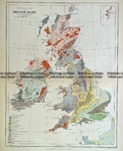
    Antique Map 232-107 Geological map of Britain by Weller c.1874

    $85.00
  • Antique Maps

    Antique Map 4-184 Britain – Geological by Chambers c. 1880

    $85.00
  • Antique Maps

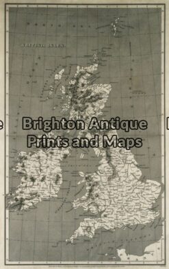
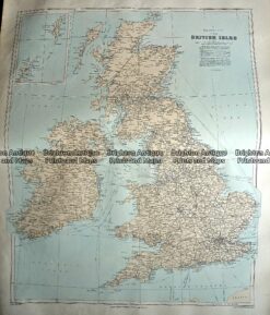
    Antique Map 233-366 Britain by Letts c.1880

    $80.00
  • Antique Maps

    Antique Map 233-348 Groot Britannia en Ierland by Wolters c.1929

    $80.00
  • Antique Maps

    Antique Map 236-017 Britain by Geographia c.1950’s

    $60.00
  • SOLD
    Books

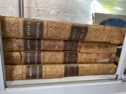
    Antique book – Atlas Camden’s Britannia c.1806 4 vols Ref: 889-009

  • SOLD
    Antique Maps

    Antique Map 230-127 Accurate map of Great Britain, France . . . by Laurie & Whittle c.1794

  • 4-172 Edinburgh street map by S.D.U.K c.1844
    SOLD
    Antique Maps

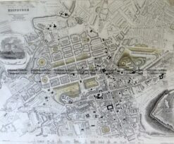
    Antique Map 237-000 Edinburgh street map by S.D.U.K c.1844

  • SOLD
    Antique Maps

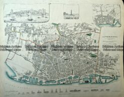
    Antique Map 4-173 Liverpool street map by S.D.U.K c.1844

  • SOLD
    Antique Maps

    Antique Map 236-029 A Plat of the Channel describing Sea Coasts of England c.1695

  • 4-197  Middlesex England by I. Slater c.1847
    SOLD
    Antique Maps

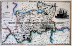
    Antique Map 4-197 Middlesex England by I. Slater c.1846

  • 4-180  England Geological map by S.D.U.K. c.1844
    SOLD
    Antique Maps

    Antique Map 4-180 England Geological map by S.D.U.K. c.1844

  • 4-178  Edinburgh and vicinity by S.D.U.K. c.1844
    SOLD
    Antique Maps

    Antique Map 4-178 Edinburgh and vicinity by S.D.U.K. c.1844

  • 4-165 - Wales Jansson - circa 1677 Hand coloured copperplate engraving 45cm X 35cm Condition A+
    SOLD
    Antique Maps

    Antique Map 4-165 – Wales Jansson – circa 1677 Hand coloured copperplate engraving 45cm X 35cm Condition A+

  • 4-168  England and Wales  c.1844
    SOLD
    Antique Maps

    Antique Map 4-168 England and Wales c.1844

  • 4-196  Yorkshire England by I. Slater c.1847
    SOLD
    Antique Maps

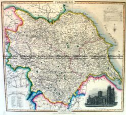
    Antique Map 4-196 Yorkshire England by I. Slater c.1846

  • 5-032 - United Kingdom - Britannicae Insule de Vaugondy - circa 1757 Outline colour copperplate engraving 53cm X 49cm Condition A
    SOLD
    Antique Maps

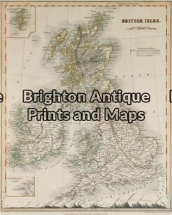
    Antique Map 5-032 – United Kingdom – Britannicae Insule de Vaugondy – circa 1757 Outline colour copperplate engraving 53cm X 49cm Condition A

  • 4-142 - England (LAngleterre) Dufour - circa 1856 Steel engraving 75cm X 55cm Condition A+
    SOLD
    Antique Maps

    Antique Map 4-142 – England (LAngleterre) Dufour – circa 1856 Steel engraving 75cm X 55cm Condition A+

  • 4-032 - Britannicae Insule de Vaugondy - circa 1757 Copperplate engraving 53cm X49cm Condition A
    SOLD
    Antique Maps

    Antique Map 4-032 – Britannicae Insule de Vaugondy – circa 1757 Copperplate engraving 53cm X49cm Condition A

Categories

  • Antique Maps
    • World
    • Australia & Pacific
    • Britain and Ireland
      • Britain
      • England
      • Wales
      • Scotland
      • Ireland
    • Europe
    • Asia
    • North America
    • South America
    • Africa
    • City Street Maps
    • Geological maps
    • Tallis
  • Antique Prints
  • Books & Gov't Reports
  • Manuscript Documents

© 2025 BRIGHTON ANTIQUE PRINTS AND MAPS. ALL RIGHTS RESERVED | Website by Blaze Online
Credit Card
Norton Safe Web Transaction
  • Home
  • Catalogue
    • Antique Maps
    • Antique Prints
    • Books & Gov’t Reports
    • Manuscript Documents
  • Recent Arrivals
  • About
  • FAQ
  • Register Interests
  • Contact Us
  • View Cart
  • Login
  • Currency
    WOOCS 2.1.5