CURRENCY
Showing all 123 resultsSorted by price: high to low
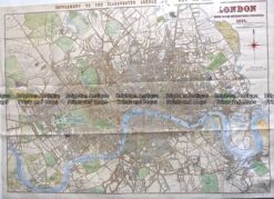
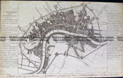
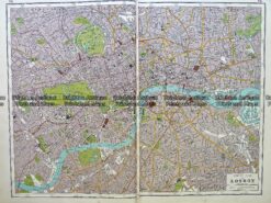
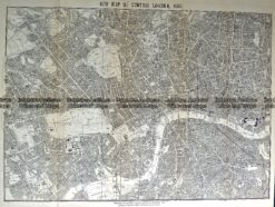
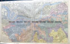
Antique Map 230-244 London street map c.1862
Antique Map – London Street Map by S.D.U.K. c.1836 Ref: 889-030
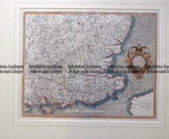
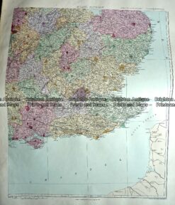
Antique map – South East England by Mercator c.1630 Ref: 415-030
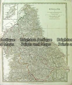
237-129 Antique Map – Warwicum, Northhamtonia, Huntingdonia . . . . by Mercator c.1630
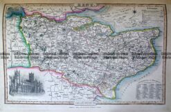
Antique map – Suffolk by Speed c.1611. Ref: 291-899
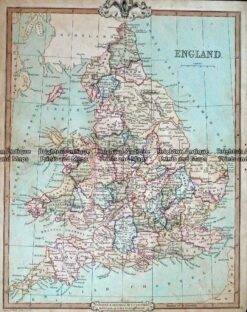
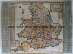
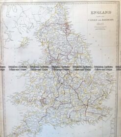
Antique Map 5-142 – England (LAngleterre) Dufour – circa 1856 Steel engraving 75cm X 55cm Condition A+
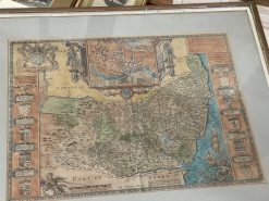
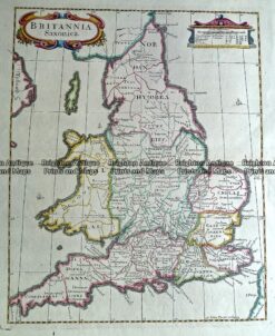
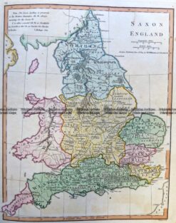
Antique Map 232-171 Britannia Saxonica by Morden c.1695
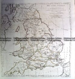
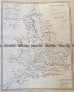
Antique Map 230-139 Britain – Britanniae Antiquae by D’Anville c.1785
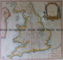
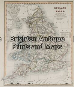
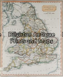
Antique Map 4-183 England and Wales by Robert c.1753
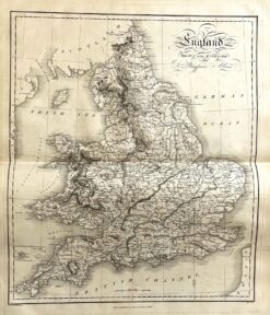
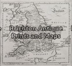
Antique map – England by Playfair c.1822. Ref: 339-011
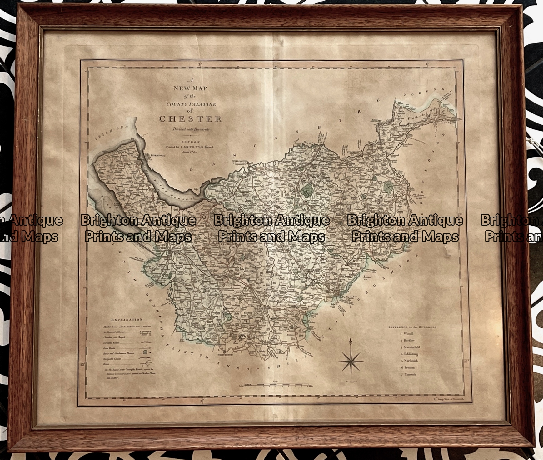
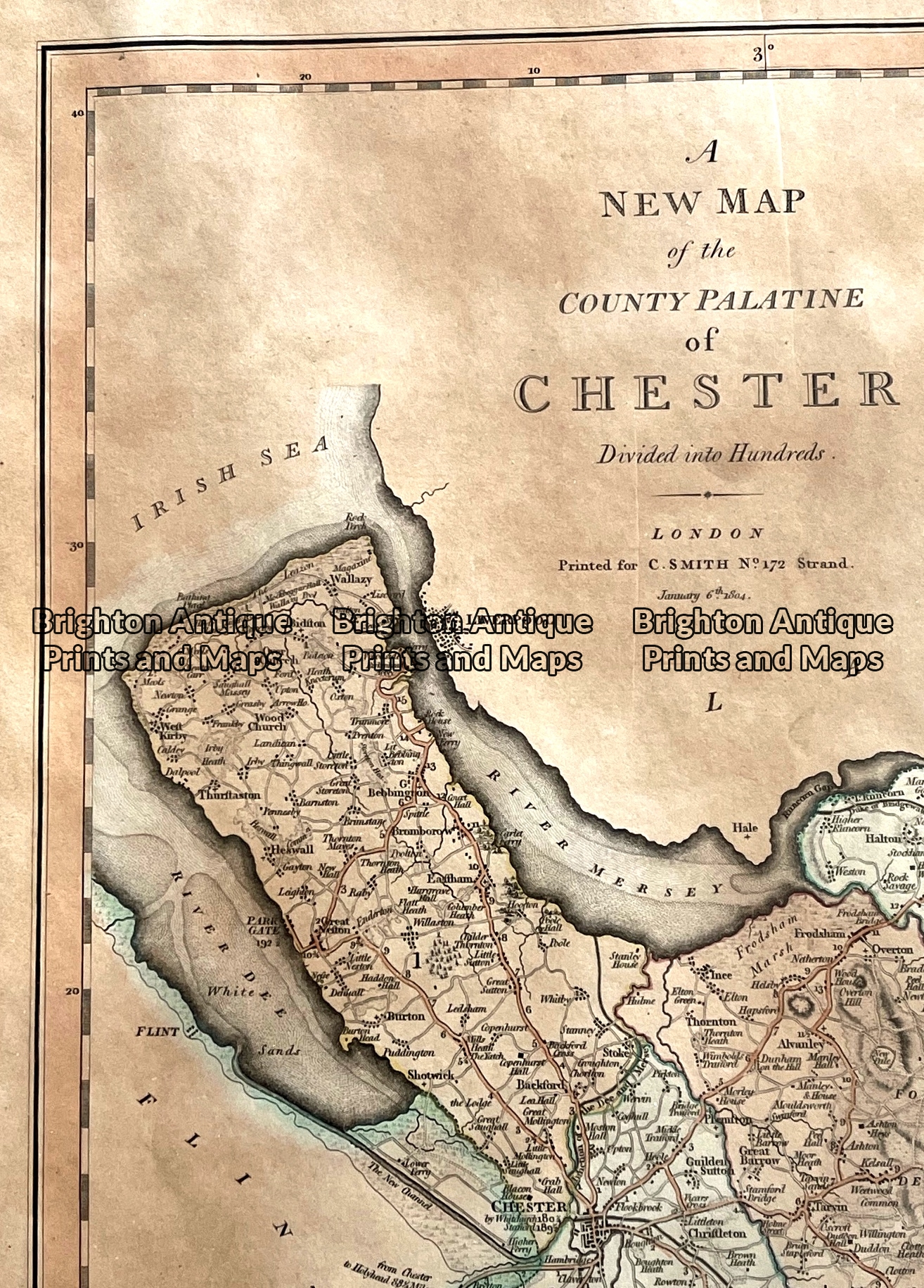
Antique map – Cheshire by C. Smith c.1804 Ref: 789-019
Antique Map 5-145 – England – Kent Harrison/Sudlow – circa 1791 Hand coloured copperplate engraving 46cm X 33cm Condition A+
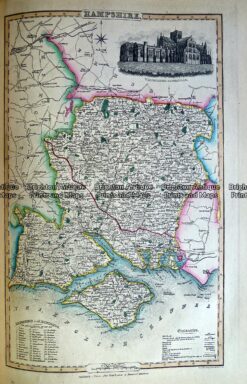
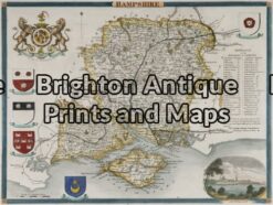
Antique Map 230-484 Hampshire by Slater c.1846
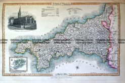
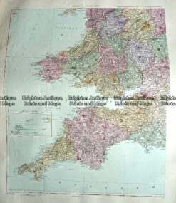
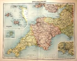
Antique Map 230-485 County of Cornwall by Slater c.1846
Antique Map 4-199 England by Teasdale c. 1847
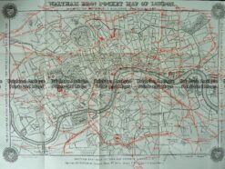
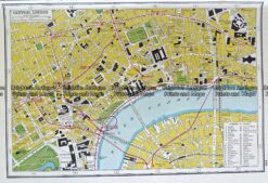
Antique map – RAC map of London c.1930’s
Antique Map 232-145 London by Harrison c.1775
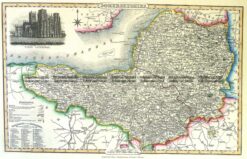
Antique Map 230-483 Kent by Slater c.1846
Antique Map 5-141 – England and Wales Downer – circa 1840 Hand coloured steel engraving 21cm X 26cm Condition A+
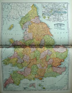
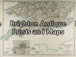
Antique Map 4-033 – England and Wales A & C Black – circa 1865 Chromolithograph 56cm X 42cm Condition A+
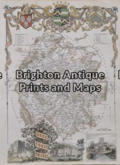
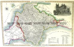
Antique Map 5-164 – England – Herefordshire Hand coloured steel engraving 19cm X 26cm Condition A+
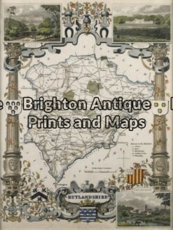
Antique Map 5-050 – England – Rutlandshire Moule – circa 1840 Hand coloured steel engraving 19cm X 26cm Condition A+
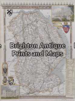
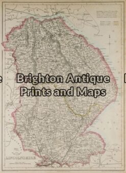
Antique Map 5-169 – England – Lincolnshire Moule – circa 1840 Hand coloured steel engraving 19cm X 26cm Condition A+
Antique Map 5-168 – England – Kent Moule – circa 1840 Hand coloured steel engraving 26cm X 19cm Condition A+
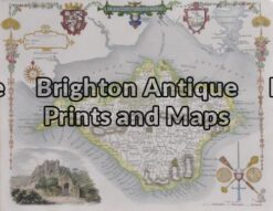
5-167 – England – Isle of Wight Moule – circa 1840 Hand coloured steel engraving 26cm X 19cm Condition A+
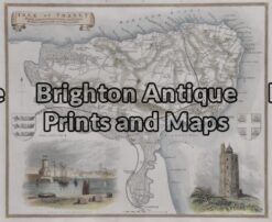
Antique Map 5-166 – England – Isle of Thanet Moule – circa 1840 Hand coloured steel engraving 26cm X 19cm Condition A+
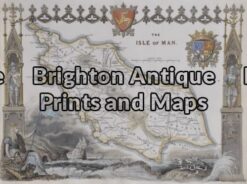
Antique Map 5-165 – England – Isle of Man Moule – circa 1840 Hand coloured steel engraving 26cm X 19cm Condition A+
Antique Map 5-146 – England – Hampshire Moule – circa 1840 Hand coloured steel engraving 25cm X 19cm Condition A+
Antique Map 5 – 163 – England – Gloucestershire Moule – circa 1840 Hand coloured steel engraving 19cm X 26cm Condition A+
Antique Map 5-162 – England – Cumberland Moule – circa 1940 Hand coloured steel engraving 19cm X 26cm Condition A+
Antique Map 5-161 – England – Berkshire Moule – circa 1840 Hand coloured steel engraving 26cm X 19cm Condition A+
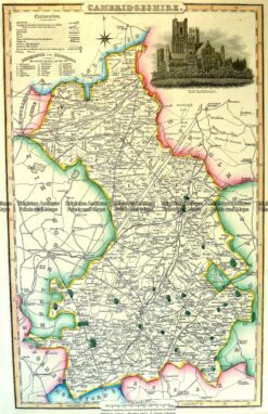
Antique Map 4-194 Cambridgeshire by I. Slater c.1846
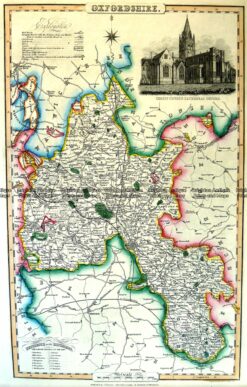
Antique Map 4-193 Oxfordshire England by I. Slater c.1846
Antique Map 4-164 – England – Northamptonshire Moule – circa 1840 Hand coloured steel engraving 19cm X 26cm Condition A+
Antique Map 4-158 – England – Isle of Man Moule – circa 1840 Hand coloured steel engraving 26cm X 19cm Condition A+
Antique Map 4-146 – England – Hampshire Moule – circa 1840 Hand coloured steel engraving 21cm X 26cm Condition A+
Antique Map – England by Kitchin c.1780 Ref: 237-363
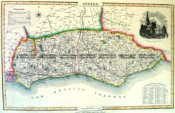
Antique Map 4-195 Sussex England by I. Slater c.1846
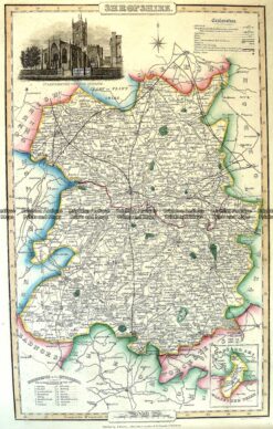
Antique Map 4-191 Shropshire England by I. Slater c.1846
Antique Map 4-189 Devonshire England by I. Slater c.1846
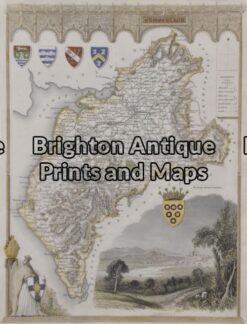
Antique Map 4-188 Somersethire England by I. Slater c.1846
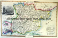
Antique Map 4-187 Essex England by I. Slater c.1846
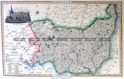
Antique Map 4-186 County of Suffolk England c.1846
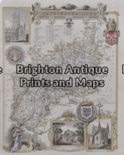
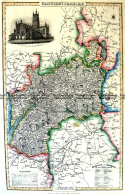
Antique Map 4-192 Gloucestershire by I. Slater c.1846
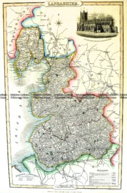
Antique Map 4-190 Lancashire England by I. Slater c.1846
Antique Map 4-177 London and vicinity by S.D.U.K. c.1844
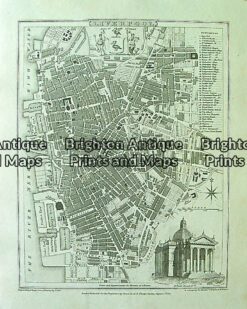
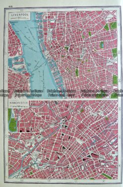
Antique Map 4-200 Liverpool street map by Moule c.1840
Antique Map 230-504 Plan of Central London c.1920
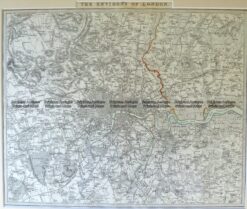
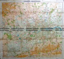
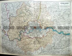
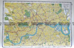
Antique Map 230-501 London Countryside by George Philip c.1920
Antique Map 232-403 England by Cruchley c.1834
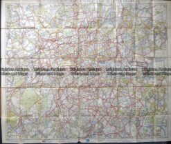
Antique Map 230-209 Railway map of London c.1880
Antique Map 233-005 London and vicinity by S.D.U.K c.1844
Antique map – Map of Kent by Roper c.1806. Ref: 415-029
Antique Map 5-144 – England – Lincolnshire J Dower – circa 1850 Steel engraving 31cm X 43cm Condition A+
Antique Map 4-167 Ancient England and Wales c.1844
Antique Map 4-144 – England – Lincolnshire J Dower – circa 1850 Steel engraving 31cm X 43cm Condition A
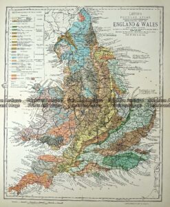
Antique Map 233-365 Geological map of England and Wales by Letts c.1880
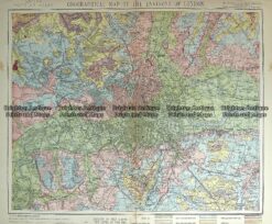
Antique Map 233-362 Geological map of Environs of London by Letts c.1880
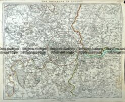
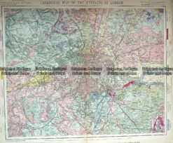
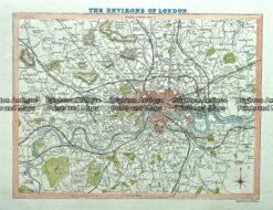
Antique Map 233-361 Environs of London by Letts c.1880
Antique Map 233-298 Outer London by Stanford c.1887
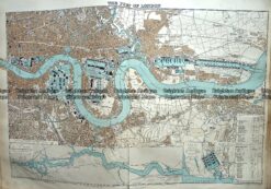
Antique Map 233-297 Port of London by Stanford c.1887
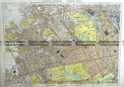
Antique Map 233-295 London – North West Central by Stanford c.1887
Antique Map 233-230 England by Rand McNally c.1894
Antique Map 4-186 England -norther Counties c.1844
Antique Map 4-189 England in Roman times by Wilkinson c.1830
Antique Map 4-140 – England and Wales George Virtue – circa 1840 Hand coloured steel engraving 20cm X 25cm Condition A+
Antique Map 4-143 – England – Southern J & C Walker – circa 1835 Steel engraving 39cm X 32cm Condition A+
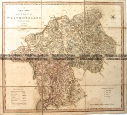
Antique Map – Westmoreland by C. Smith c.1808 Ref: 889-026
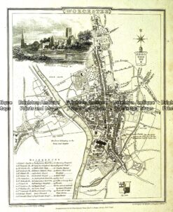
Antique map – Worcester Street Map by Verner, Hood & Sharpe c.1805 Ref#232-750
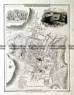
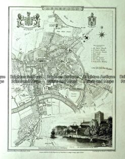
Antique map – Winchester Street Map by Verner, Hood & Sharpe c.1805 Ref#232-749
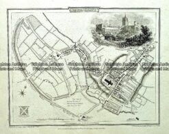
Antique map – St Alban’s Street Map by Verner, Hood & Sharpe c.1805 Ref#232-748
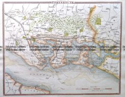
Antique map – Portsmouth by Verner, Hood & Sharpe c.1805 Ref#232-747
Antique map – Northampton Street Map by Verner, Hood & Sharpe c.1805 Ref#232-746
Antique map – Norwich Street Map by Verner, Hood & Sharpe c.1805 Ref#232-745
Antique map – Manchester & Salford Street Map by Verner, Hood & Sharpe c.1805 Ref#232-744
Antique map – Environs of London by Verner, Hood & Sharpe c.1805 Ref#232-743
Antique map – Hereford Street Map by Verner, Hood & Sharpe c.1805 Ref#232-742
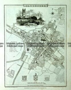
Antique map – Glocester Street Map by Verner, Hood & Sharpe c.1805 Ref#232-741
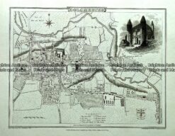
Antique map – Colchester Street Map by Verner, Hood & Sharpe c.1805 Ref#232-740
Antique map – Derby Street Map by Verner, Hood & Sharpe c.1805 Ref#232-739
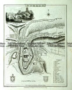
Antique map -Durham Street Map by Verner, Hood & Sharpe c.1805 Ref#232-738
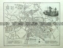
Antique map – Coventry Street Map by Verner, Hood & Sharpe c.1805 Ref#232-721
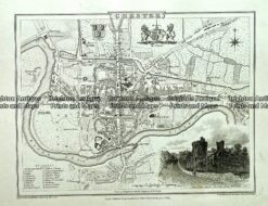
Antique map – Chester Street Map by Verner, Hood & Sharpe c.1805 Ref#232720
Antique map – Carlisle street map by Verner, Hood & Sharpe c.1805 Ref# 232-719
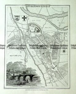
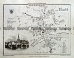
Antique map – Bedford Street Map by Verner, Hood & Sharpe c.1805 Ref# 232-716
Antique Map 236-030 Royaume d’Angleterre (southern England) by Bonne & Desmarest c.1787
Antique Map 232-154 England & Wales by Lewis c.1846
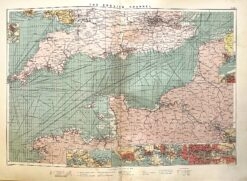
Antique map – English Channel and shipping routes c.1913. Ref: 339-019
Antique map – London street map by Harmsworth c.1920 Ref# 232-917
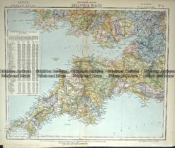
Antique Map 233-294 England and Wales – South West by Stanford c.1887
Antique Map 233-293 England – South East England by Stanford c.1887
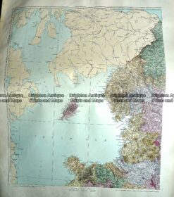
Antique Map 233-292 England – north west by Stanford c.1887
Antique Map 233-291 England – North East by Stanford c.1887
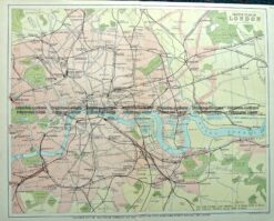
Antique Map 4-140 London and vicinity c.1892
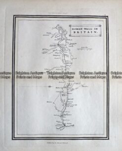
Antique Map – Roman Wall in Britain c.1800 Ref 237-334
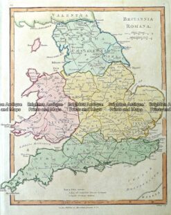
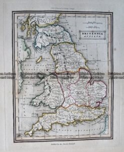
Antique Map – Britannia Antiqua c.1800 Ref: 237-330
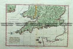
Antique map – Cornwall, Devon & Somerset by Bartholomew c.1898. Ref: 339-011
Antique map – Liverpool and Manchester by Harmsworth c.1920 Ref# 232-916
Antique map – London street map by Harmsworth c.1920 Ref# 232-915
Antique map – London street map by Harmsworth c.1920 Ref# 232-914
Antique map – Street maps of London, Edinburgh and Dublin c.1906 Ref# 232-912
Antique Map 233-364 Wales – northern by Letts c.1880
Antique map – English street maps by Harmsworth c.1920 Ref# 232-906
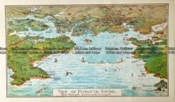
Antique Map 232 – Plymouth Harbour by Gordon & Gotch c.1889
Antique Map 233-363 England – Cornwall, Somerset, Devon by Letts c.1880
Antique Map 4-174 England and Wales by Chatelain c.1719
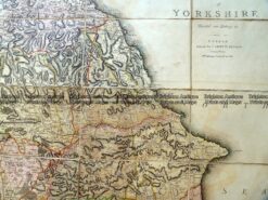
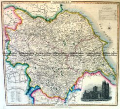
Antique Map – Yorkshire divided into Ridings by C. Smith c.1808 Ref: 889-025
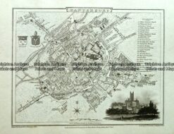
Antique map – street map of Canterbury by Vernor, Hood & Sharpe c.1805 Ref# 232-717
Antique Map 232-265 London by Gordon & Gotch c.1889
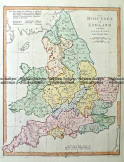
Antique Map 232-104 Dioceses of England by Wilkinson c.1830
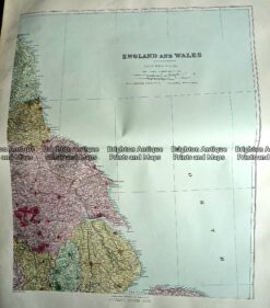
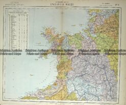
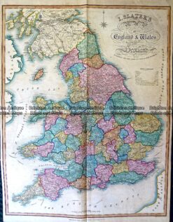
Antique Map 230-488 England and Wales by Slater c.1846
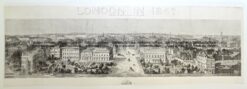
Antique Map 4-184 London panorama 1842
Antique Map 5-037 – London and its Enviroment B Davies – circa 1854 Hand coloured steel engraving 70cm X 70cm Condition A+
Antique Map 4-183 England – Britanniae Sive Angliae Regnum by Seutter c.1740
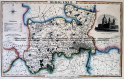
Antique Map 4-197 Middlesex England by I. Slater c.1846
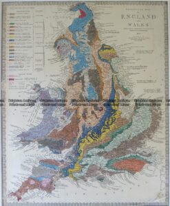
Antique Map 4-180 England Geological map by S.D.U.K. c.1844
Antique Map 5-268 England in Saxon Times by Wilkinson c.1830
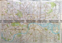
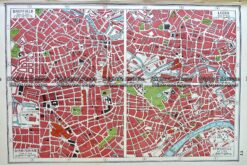
Antique Map 4-188 London Street Map by Letts c. 1883
Antique Map 5-031 – England A Ball – circa 1773 Copperplate engraving Condition A+
Antique Map 5-147 – England – Hertfordshire Moule – circa 1840 Hand coloured steel engraving 25cm X 19cm Condition A+
Antique Map 4-168 England and Wales c.1844
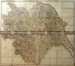
Antique Map 4-196 Yorkshire England by I. Slater c.1846