Brighton Antique Prints and Maps
Currency
WOOCS 2.1.5
VIEW CART
  • CURRENCY

    WOOCS 2.1.5
  • Home
  • Catalogue
    • Antique Maps
    • Antique Prints
    • Books & Gov’t Reports
    • Manuscript Documents
  • Recent Arrivals
  • About
  • FAQ
  • Register Interests
  • Contact Us

Home/Antique Maps/Australia & Pacific/Victoria

Showing all 129 results

Filter
  • Victoria

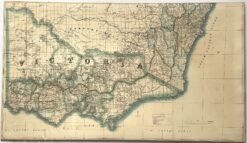
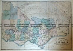
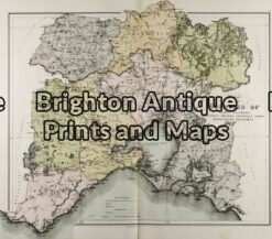
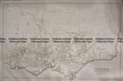
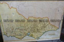
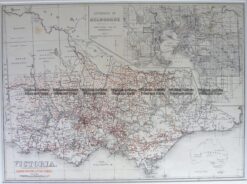
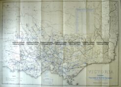
    Antique map – Victoria by Proeschel c.1863. Ref: 339-038

    $2,250.00
  • Victoria

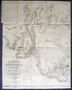
    Antique map – Gold fields in South Australia c.1853Ref: 339-009

    $1,700.00
  • Antique Maps

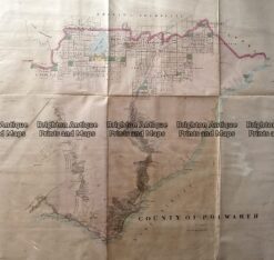
    Antique Map 233-453 Victoria – County of Polwarth by Bailliere c.1866

    $1,600.00
  • Antique Maps

    Antique Map 233-451 Victoria – County of Hampden by Bailliere c.1866

    $1,600.00
  • Antique Maps

    Antique Map 233-450 Victoria – County of Normanby by Bailliere c.1866

    $1,600.00
  • Antique Maps

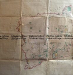
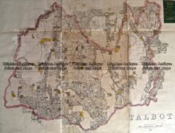
    Antique Map 233-454 Victoria – County of Talbot by Bailliere c.1866

    $1,500.00
  • Antique Maps

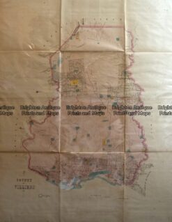
    Antique Map 233-452 Victoria – County of Villiers by Bailliere c.1866

    $1,500.00
  • Antique Maps

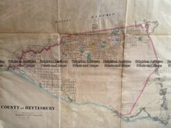
    Antique Map 233-455 Victoria – County of Heytesbury by Bailliere c.1866

    $1,200.00
  • Victoria

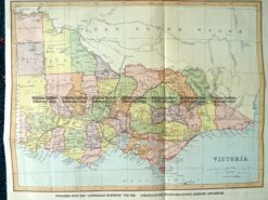
    Antique Map – Map of Victoria by Hiscock c.1874 Ref No. 238-003

    $750.00
  • Victoria

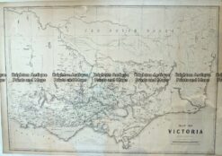
    Antique Map – Victoria c.1865 Ref No. 238-001

    $750.00
  • 14-230 - County of Anglesey Hiscock  - circa 1874 Hand coloured lithograph 51cm X 39cm Condition A+
    Antique Maps

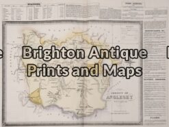
    Antique Map 14-230 – County of Anglesey Hiscock – circa 1874 Hand coloured lithograph 51cm X 39cm Condition A+

    $590.00
  • Victoria

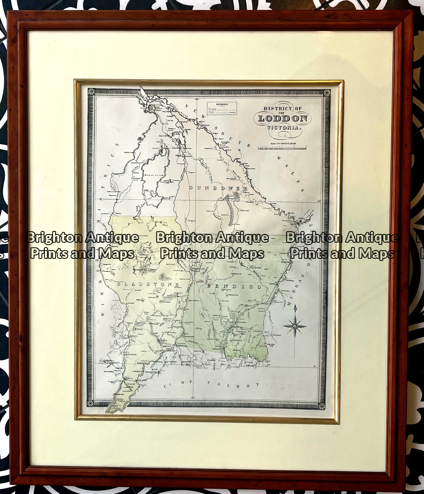
    Antique map – Counties in Loddon District of Victoria by Hiscock c.1874. Ref: 789-017

    $575.00
  • Victoria

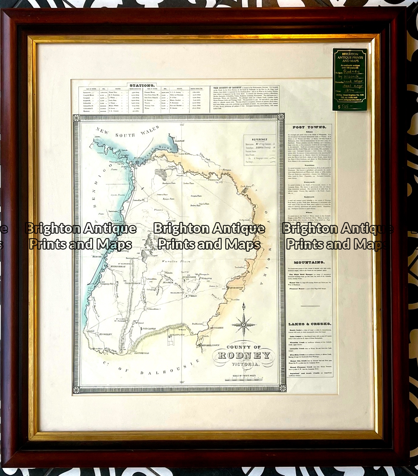
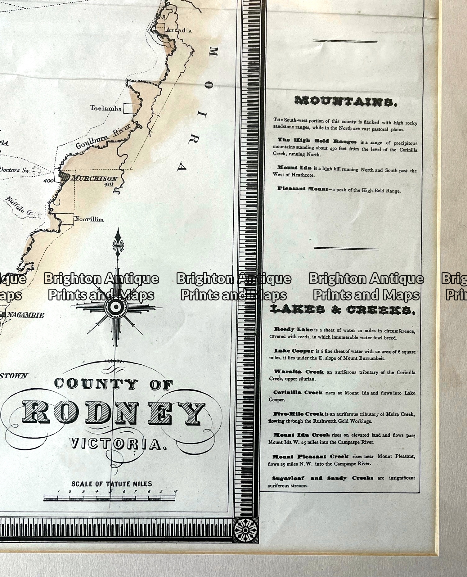
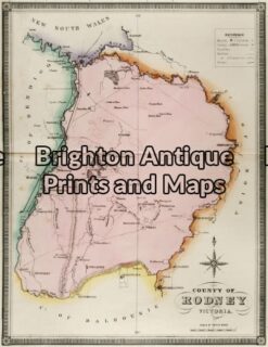
    Antique map – County of Rodney by Hiscock c.1874 Ref: 789-016

    $575.00
  • Antique Maps

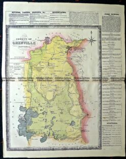
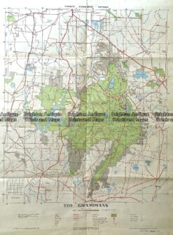
    Antique Map 14-229 – County of Grenville Hiscock – circa 1874 Hand coloured lithograph 41cm X 49cm Condition A+

    $550.00
  • Antique Maps

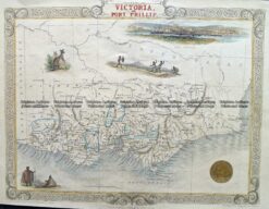
    Antique Map 14-201 – Victoria or Port Phillip John Tallis – circa 1851 Steel engraving 33cm X 26cm Condition A+

    $490.00
  • 14-220 - Victoria - County of Rodney F E Hiscock - circa 1874 Hand coloured lithograph 42cm X 49cm Condition A+
    Antique Maps

    Antique Map 14-220 – Victoria – County of Rodney F E Hiscock – circa 1874 Hand coloured lithograph 42cm X 49cm Condition A+

    $490.00
  • 14-221 - Victoria - County of Dalhousie F E Hiscock - circa 1874 Hand coloured lithograph 52cm X 40cm Condition A+
    Antique Maps

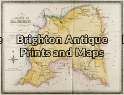
    Antique Map 14-221 – Victoria – County of Dalhousie F E Hiscock – circa 1874 Hand coloured lithograph 52cm X 40cm Condition A+

    $490.00
  • 14-216 - Victoria - Port Phillip and vicinity John Sands - circa 1886 Chromolithograph 52cm X 42cm Condition A+
    Antique Maps

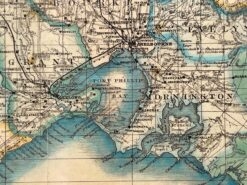
    Antique Map 14-216 – Victoria – Port Phillip and vicinity John Sands – circa 1886 Chromolithograph 52cm X 42cm Condition A+

    $480.00
  • Antique Maps

    Antique Map 236-034 Geological map of Melbourne c.1860

    $400.00
  • 14-217 - Victoria - County of Tanjil John Sands - circa 1886 Chromolithograph 52cm X 42cm Condition A+
    Antique Maps

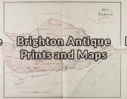
    Antique Map 14-217 – Victoria – County of Tanjil John Sands – circa 1886 Chromolithograph 52cm X 42cm Condition A+

    $290.00
  • 14-218 - Victoria - Counties of Moira
    Antique Maps

    Antique Map 14-218 – Victoria – Counties of Moira, Delatite & Bogong John Sands – circa 1886 Chromolithograph 52cm X 42cm Condition A+

    $290.00
  • 3-330  Victoria Railway lines c.1886
    Antique Maps

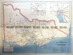
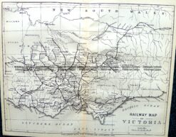
    Antique Print Antique Map 3-330 Victoria Railway lines c.1886

    $275.00
  • 14-205 - Victoria - Tanjil J Sands - circa 1886 Chromolithograph 53cm X 43cm Condition A+
    Antique Maps

    Antique Map 14-205 – Victoria – Tanjil J Sands – circa 1886 Chromolithograph 53cm X 43cm Condition A+

    $240.00
  • Victoria

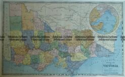
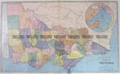
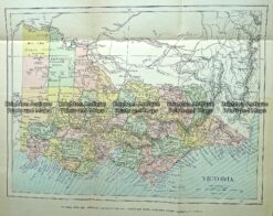
    Antique Map – General Map of Victoria c.1886 Ref No. 238-007

    $225.00
  • 14-336  Victoria - showing State Schools  c.1886
    Antique Maps

    Antique Map 14-336 Victoria – showing State Schools c.1886

    $225.00
  • 3-203 - Victoria Picturesque Atlas  circ 1886 Chromolithograph 61cm X 37cm Condition A+
    Antique Maps

    Antique Map 3-203 – Victoria Picturesque Atlas circ 1886 Chromolithograph 61cm X 37cm Condition A+

    $225.00
  • Antique Maps

    Antique Map 236-044 Gold mining – cross-sections of mines in Sandhurst (Bendigo)

    $200.00
  • 14-334  Victoria - Geology - Stawell
    Antique Maps

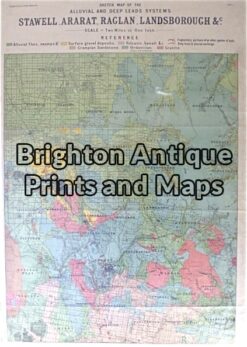
    Antique Map 14-334 Victoria – Geology – Stawell, Ararat, Raglan, Landsborough, etc c.1910

    $190.00
  • Victoria

    Antique map – Western Victoria c.1930 Ref: 889-023

    $180.00
  • 3-820  Victoria Water Supply by Fergusson & Mitchell  c.1888
    Antique Maps

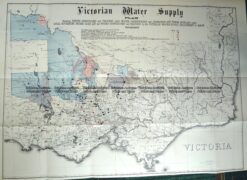
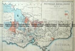
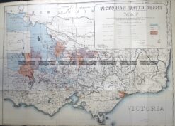
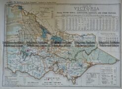
    Antique Map 3-820 Victoria Water Supply by Fergusson & Mitchell c.1888

    $175.00
  • Antique Maps

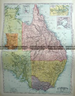
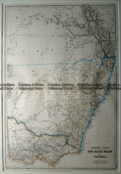
    Antique Map 233-225 Australia – Victoria, NSW, Queensland by Rand McNally c.1894

    $160.00
  • 3-831 Moorabbin street map  c.1949
    Antique Maps

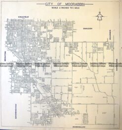
    Antique Map 3-831 Moorabbin street map c.1949

    $160.00
  • Victoria

    Antique map – Grampians Tourist Map c.1933 Ref: 889-022

    $150.00
  • 9-813  Victoria Railway Map  c.1883
    Antique Maps

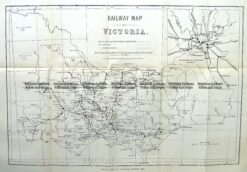
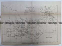
    Antique Map 9-813 Victoria Railway Map c.1883

    $150.00
  • Victoria

    Antique Map – Victorian Water Supply c.1890 Ref No. 238-002

    $125.00
  • Antique Maps

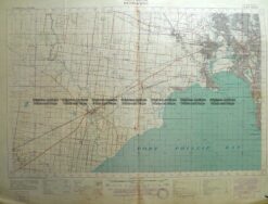
    Antique Map 230-226 Military map of Western Port Vic c.1940

    $125.00
  • 9-812  Victoria - Railway Map  c.1896
    Antique Maps

    Antique Map 9-812 Victoria – Railway Map c.1896

    $125.00
  • 3-830  Doutta Galla in County of Bourke  c.1969
    Antique Maps

    Antique Map 3-830 Doutta Galla in County of Bourke c.1969

    $125.00
  • 9-138  Victoria by Gordon & Gotch  c.1880
    Victoria

    9-138 Victoria by Gordon & Gotch c.1880

    $125.00
  • 3-823  Victoria Water Supply  c.1890
    Antique Maps

    Antique Map 3-823 Victoria Water Supply c.1890

    $125.00
  • Victoria

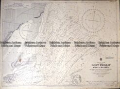
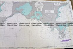
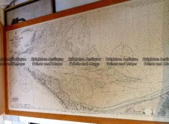
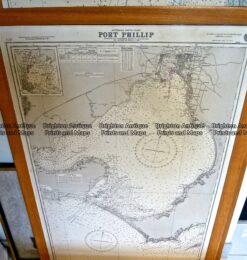
    Antique map – Navigation Chart of West Channel Port Phillip c.1903 Ref: 415-027

    $100.00
  • Antique Maps

    Antique Map 230-101 Navigation Chart – Victoria c.1973

    $100.00
  • Victoria

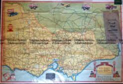
    Antique Map – Road Map of Victoria by Vacuum Oil Co. c.1930’s Ref No. 238-005

    $89.00
  • Victoria

    Antique map – Port Fairy area military map c.1942 Ref: 889-021

    $85.00
  • Antique Maps

    Antique Map 232-266 Port Fairy military map c.1942

    $85.00
  • 9-129  Military map of Melbourne c.1931
    Antique Maps

    Antique Map 9-129 Military map of Melbourne c.1931

    $85.00
  • 9-833  Bairnsdale -Military Map c.1942
    Antique Maps

    Antique Map 9-833 Bairnsdale -Military Map c.1942

    $85.00
  • Antique Maps

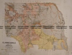
    Antique Map 236-233 Geological map of Clarkesdale area in Victoria

    $80.00
  • Victoria

    Antique Map – Western Victoria c.1960 Ref: 889-024

    $79.00
  • Victoria

    Antique Map – Road Map of Victoria by Robinson c.1930’s Ref No. 238-004

    $79.00
  • Victoria

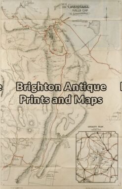
    234-003 Antique map – The Grampians c.1971

    $75.00
  • 3-828  Victoria - Bittern in County of Mornington  c.1950
    Antique Maps

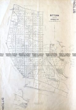
    Antique Map 3-828 Victoria – Bittern in County of Mornington c.1950

    $75.00
  • 3-306  Victoria - Geelong region military map  c. 1928
    Antique Maps

    Antique Map 3-306 Victoria – Geelong region military map c. 1955

    $75.00
  • 3-824  Victoria - County of Anglesey  c.1958
    Antique Maps

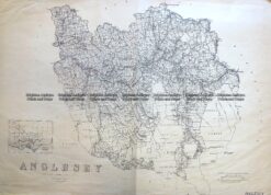
    Antique Map 3-824 Victoria – County of Anglesey c.1958

    $75.00
  • Antique Maps

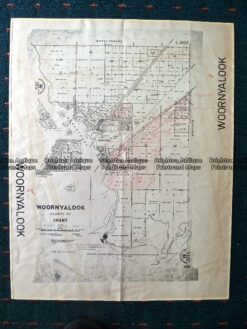
    Antique Map 230-507 Woornyalook parish map c. 1940

    $65.00
  • 3-311  Victoria - Western suburbs of Melbourne c.1933
    Antique Maps

    Antique Map 3-311 Victoria – Western suburbs of Melbourne c.1933

    $65.00
  • 29-484  Port Phillip - bird's eye view  c.1906
    Antique Maps

    Antique Print Antique Map 29-484 Port Phillip – bird’s eye view c.1906

    $65.00
  • Antique Maps

    Antique Map 232-090 Victoria by Gordon & Gotch c.1889

    $55.00
  • Victoria

    Antique map – Military and Dept of Lands & Survey maps Ref: 235-005

    $50.00
  • Victoria

    Antique map – Hamilton Victoria c.1968 Ref: 889-020

    $50.00
  • Antique Maps

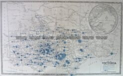
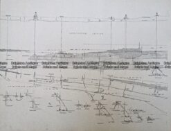
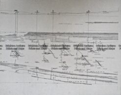
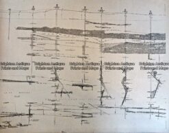
    Antique Print Antique Map 233-237 Gold Mines in Victoria – Ballarat and Bendigo c.1880’s

    $50.00
  • Antique Maps

    Antique Print Antique Map 233-236 Gold Mines in Victoria – Ballarat and Bendigo c.1880’s

    $50.00
  • Antique Maps

    Antique Print Antique Map 233-235 Gold Mines in Victoria – Ballarat and Bendigo c.1880’s

    $50.00
  • Antique Maps

    Antique Print Antique Map 233-234 Gold Mines in Victoria – Ballarat and Bendigo c.1880’s

    $50.00
  • Antique Maps

    Antique Print Antique Map 233-233 Gold Mines in Victoria – Ballarat and Bendigo c.1880’s

    $50.00
  • Antique Maps

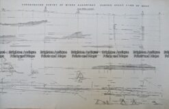
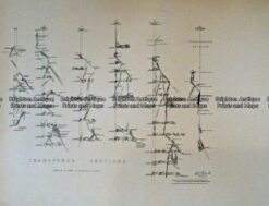
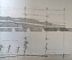
    Antique Print Antique Map 233-232 Gold Mines in Victoria – Cross-section detail c.1880’s

    $50.00
  • Antique Maps

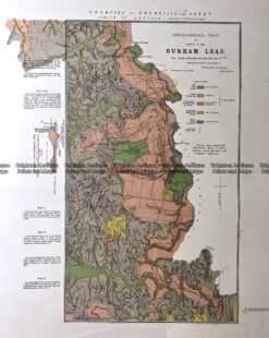
    Antique Map 236-020 Geological map of Durham in Victoria c.1890

    $50.00
  • Antique Maps

    Antique Map 230 -100 Navigation Chart – Victoria 1990’s

    $50.00
  • 3-304  Victoria - Ringwood area  c.1935
    Antique Maps

    Antique Map 3-304 Victoria – Ringwood area c.1935

    $45.00
  • 3-303  Victoria - Moe area  c.1940
    Antique Maps

    Antique Map 3-303 Victoria – Moe area c.1940

    $45.00
  • Antique Maps

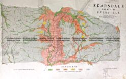
    Antique Map 236-019 Geological map of Scarsdale in Victoria c.1889

    $40.00
  • Antique Maps

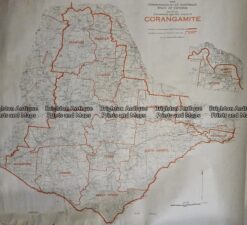
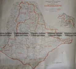
    Antique Map 233–242 Corangamite – Commonwealth Electoral Division

    $30.00
  • Antique Maps

    Antique Map 236-036 Corangamite – Commonwealth Electoral Division c.1977

    $25.00
  • 3-825  Victoria Parish and town of Avenel  c.1954
    SOLD
    Antique Maps

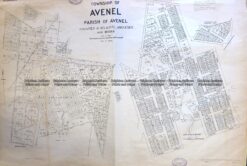
    Antique Map 3-825 Victoria Parish and town of Avenel c.1954

  • SOLD
    Victoria

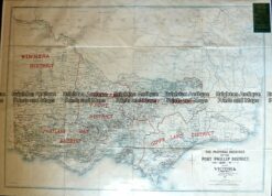
    Antique Map – Pastoral Holdings of Port Phillip District c.1932 Ref No. 238-006

  • SOLD
    Antique Maps

    Antique Map 233-368 Navigation Chart – Mornington Peninsula c.1960’s

  • SOLD
    Antique Maps

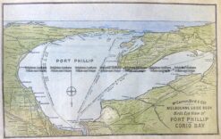
    Antique Map 233-367 Navigation Chart – Port Phillip c.1960’s

  • SOLD
    Antique Maps

    Antique Map 236-038 Victoria – for intending settlers c.1922

  • SOLD
    Antique Maps

    Antique Map 236-035 Victoria Mining Districts, & Gold fields c.1866

  • SOLD
    Antique Maps

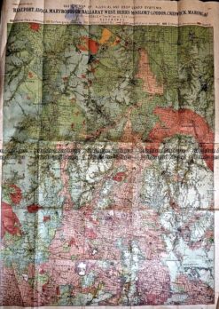
    Antique Map 236-032 Geological map of Beaufort, Avoca, Maryborough, Ballarat area

  • SOLD
    Antique Maps

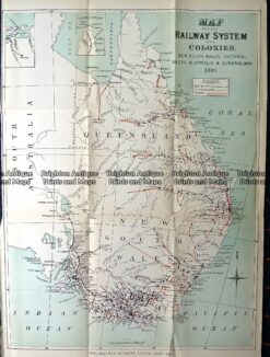
    Antique Map 232-110 Australia (eastern) Railway System c.1889

  • SOLD
    Antique Maps

    Antique Map 230-607 Yarra Valley and North East Hill Country c.1970

  • SOLD
    Antique Maps

    Antique Map 230-492 Grampians – geological map c.1960

  • SOLD
    Antique Maps

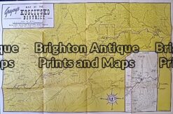
    Antique Map 230-817 Mount Kosciusko District tourist map c.1970

  • SOLD
    Antique Maps

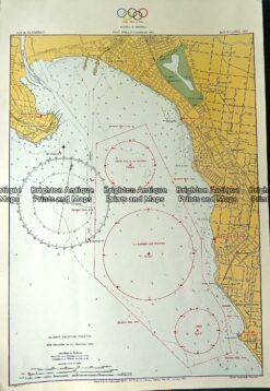
    Antique Print Antique Map 230-203 Port Phillip – 1956 Olympic yachting map

  • SOLD
    Antique Maps

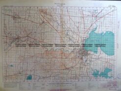
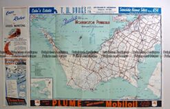
    Antique Map 230-198 Mornington Peninsula c.1950’s

  • SOLD
    Antique Maps

    Antique Map 230-185 Victoria – Railway map c.1888

  • 3-308  Victoria - Wonthaggi & Inverloch  c.1930
    SOLD
    Antique Maps

    Antique Map 3-308 Victoria – Wonthaggi & Inverloch c.1930

  • SOLD
    Antique Maps

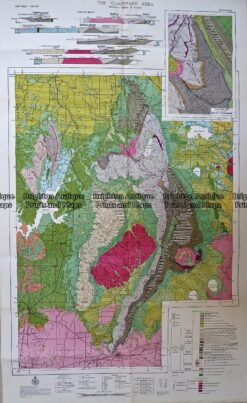
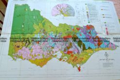
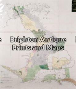
    Antique Map 230-151 Geological map of Victoria c. 1963

  • SOLD
    Antique Maps

    Antique Map 230-143 Bass Strait – Die Nordkuste von Bass Strasse c.1806

  • SOLD
    Antique Maps

    Antique Map 230-111 Queensland, NSW and Victoria c.1870

  • SOLD
    Antique Maps

    Antique Map 230-104 Victoria – Mining Districts c.1869

  • 14-226 - Mornington Peninsula Meikle - circa 1854 Colour wash lithograph 50cm X 60cm Condition A+
    SOLD
    Antique Maps

    Antique Map 14-226 – Mornington Peninsula Meikle – circa 1854 Colour wash lithograph 50cm X 60cm Condition A+

  • 14-225 - Western Port and Cape Patterson Govt Printer  - circa 1872 Chromolithograph 50cm X 40cm Condition A+
    SOLD
    Antique Maps

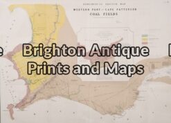
    Antique Map 14-225 – Western Port and Cape Patterson Govt Printer – circa 1872 Chromolithograph 50cm X 40cm Condition A+

  • 14-212 - Port Phillip - Navigation Chart  - circa 1956 65cm X 96cm Condition B
    SOLD
    Antique Maps

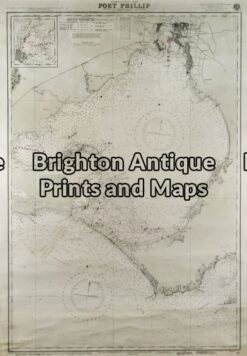
    Antique Map 14-212 – Port Phillip – Navigation Chart – circa 1969 65cm X 96cm Condition B

  • 14-203 - Victoria Picturesque Atlas - circa 1886 Chromolithograph 61cm C 37cm Condition A+
    SOLD
    Antique Maps

    Antique Map 14-203 – Victoria Picturesque Atlas – circa 1886 Chromolithograph 61cm C 37cm Condition A+

  • 14-206 - Victoria - Mallee District Department of Lands & Survey - circa 1898 Hand coloured lithograph 61cm X 75cm Condition A+
    SOLD
    Antique Maps

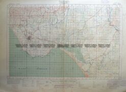
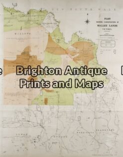
    Antique Map 14-206 – Victoria – Mallee District Department of Lands & Survey – circa 1898 Hand coloured lithograph 61cm X 75cm Condition A+

  • 14-213 - Victoria - Navigation Chart Port Phillip to Gabo Island Davies & Co - circa 1945 Lithograph 99cm X 67cm Condition A+
    SOLD
    Antique Maps

    Antique Map 14-213 – Victoria – Navigation Chart Port Phillip to Gabo Island Davies & Co – circa 1945 Lithograph 99cm X 67cm Condition A+

  • 4-970  Geelong Harbour Navigation Chart c.1934
    SOLD
    Antique Maps

    Antique Map 4-970 Geelong Harbour Navigation Chart c.1934

  • 14-332 - Yarra Valley - Yan Yean
    SOLD
    Antique Maps

    Antique Map 14-332 – Yarra Valley – Yan Yean, Maroondah & OShannassy Ritchie – circa 1900 Lithograph 34cm X 25cm Condition A+

  • 3-832 Melbourne - Street map of Pakenham  c.1848
    SOLD
    Antique Maps

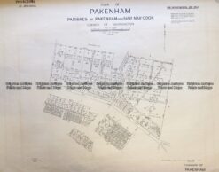
    Antique Map 3-832 Melbourne – Street map of Pakenham c.1948

  • 9-815  Shipping - Mail Service to Australia in 1883
    SOLD
    Antique Maps

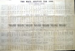
    Antique Map 9-815 Shipping – Mail Service to Australia in 1883

  • 14-335  Victoria showing State Schools  c.1893
    SOLD
    Antique Maps

    Antique Map 14-335 Victoria showing State Schools c.1893

  • 3-829  Victoria - Swan Hill in Parish of Castle Donnington  c.1960
    SOLD
    Antique Maps

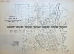
    Antique Map 3-829 Victoria – Swan Hill in Parish of Castle Donnington c.1960

  • 9-814  Victoria  c.1896
    SOLD
    Antique Maps

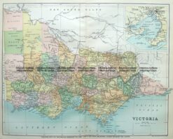
    Antique Map 9-814 Victoria c.1896

  • 3-827  Victoria Berwick in County of Mornington  c.1960
    SOLD
    Antique Maps

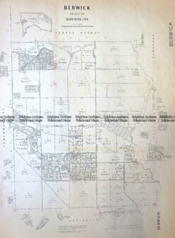
    Antique Map 3-827 Victoria Berwick in County of Mornington c.1960

  • 9-835  Scouts' Jamboree Hike Map c.1935
    SOLD
    Antique Maps

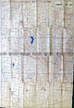
    Antique Map 9-835 Scouts’ Jamboree Hike Map c.1935

  • 14-207 - Victoria - Grampians District Department of Lands & Survey Photo-lithography 43cm X 67cm Condition A+
    SOLD
    Antique Maps

    Antique Map 14-207 – Victoria – Grampians District Department of Lands & Survey Photo-lithography 43cm X 67cm Condition A+

  • 3-309  Victoria - Korumburra & Leongatha area  c.1931
    SOLD
    Antique Maps

    Antique Map 3-309 Victoria – Korumburra & Leongatha area c.1931

  • 3-826  Victoria - Ballarat street map  c.1932
    SOLD
    Antique Maps

    Antique Map 3-826 Victoria – Ballarat street map c.1932

  • 14-333  Gold Field Creswick c.1880
    SOLD
    Antique Maps

    Antique Map 14-333 Gold Field Creswick c.1880

  • 14-332  Gold Field - Clunes c.1883
    SOLD
    Antique Maps

    Antique Map 14-332 Gold Field – Clunes c.1883

  • 9-145  Port Phillip and Melbourne  by Arrowsmith c.1841
    SOLD
    Antique Maps

    Antique Map 9-145 Port Phillip and Melbourne by Arrowsmith c.1841

  • 3-331  Wilson's Promontory National Park  c.1930
    SOLD
    Antique Maps

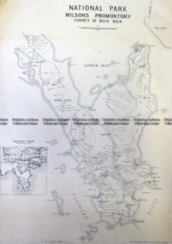
    Antique Map 3-331 Wilson’s Promontory National Park c.1930

  • 3-307  Victoria - Anglesea area  c.1926
    SOLD
    Antique Maps

    Antique Map 3-307 Victoria – Anglesea area c.1926

  • 3-305  Victoria - Alberton region military map  c.1942
    SOLD
    Antique Maps

    Antique Map 3-305 Victoria – Alberton region military map c.1942

  • 3-528  Flinders chart of Victoria coast  c.1814
    SOLD
    Antique Maps

    Antique Map 3-528 Flinders chart of Victoria coast c.1814

  • 3-897  Victoria - Navigation Chart - Western Port  c.1867 (1903)
    SOLD
    Antique Maps

    Antique Map 3-897 Victoria – Navigation Chart – Western Port c.1867 (1903)

  • 3-822  Victoria - showing butter factories  c.1905
    SOLD
    Antique Maps

    Antique Map 3-822 Victoria – showing butter factories c.1905

  • 14-337  Victoria - Bass Strait by Freycinet  c.1811 (1812)
    SOLD
    Antique Maps

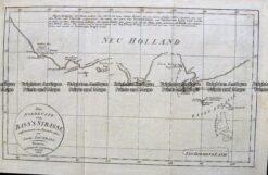
    Antique Map 14-337 Victoria – Bass Strait by Freycinet c.1811 (1812)

  • 14-204 - Victoria & Bass Strait Vandermaelen - circa 1827 Hand coloured steel engraving 56cm X 47cm Condition A+
    SOLD
    Antique Maps

    Antique Map 14-204 – Victoria & Bass Strait Vandermaelen – circa 1827 Hand coloured steel engraving 56cm X 47cm Condition A+

  • 14-208 - Victoria - Western coastline Vandermaelen - circa 1827 Hand coloured engraving 57cm X 48cm Condition A+
    SOLD
    Antique Maps

    Antique Map 14-208 – Victoria – Western coastline Vandermaelen – circa 1827 Hand coloured engraving 57cm X 48cm Condition A+

  • 14-209 - Victoria - Shepparton district Anon - circa 1890 Lithograph 40cm X 50cm Condition A+
    SOLD
    Victoria

    14-209 – Victoria – Shepparton district Anon – circa 1890 Lithograph 40cm X 50cm Condition A+

  • 14-214 - Victoria - Rye Beach Estate Real Estate sub-division Robert Harding - circa 1910 - 1920 97cm X 75cm Condition A+
    SOLD
    Victoria

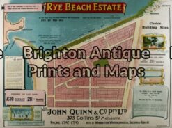
    14-214 – Victoria – Rye Beach Estate Real Estate sub-division Robert Harding – circa 1910 – 1920 97cm X 75cm Condition A+

  • 14-210 - Victoria - Portland district Admiralty Chart - circa 1835 Steel engraving 46cm X 63cm Condition A+
    SOLD
    Antique Maps

    Antique Map 14-210 – Victoria – Portland district Admiralty Chart – circa 1835 Steel engraving 46cm X 63cm Condition A+

  • 14-227 - Melbourne CBD - Yarra River Proposed improvements to docks Goode - circa 1879 Lithograph 120cm X 50cm Condition A+
    SOLD
    Antique Maps

    Antique Map 14-227 – Melbourne CBD – Yarra River Proposed improvements to docks Goode – circa 1879 Lithograph 120cm X 50cm Condition A+

  • 14-223 - Melbourne and Suburbs Anon - circa 1896 Chromolithograph 40cm X 60cm Condition A (tear left side)
    SOLD
    Antique Maps

    Antique Map 14-223 – Melbourne and Suburbs Anon – circa 1896 Chromolithograph 40cm X 60cm Condition A (tear left side)

  • 14-228 - Melbourne and Suburbs Anon  - circa 1887 Hand coloured lithograph 95cm X 100cm Condition A
    SOLD
    Antique Maps

    Antique Map 14-228 – Melbourne and Suburbs Anon – circa 1887 Hand coloured lithograph 95cm X 100cm Condition A

  • 3-870  New South Wales and South Australia c.1845
    SOLD
    Antique Maps

    Antique Map 3-870 New South Wales and South Australia c.1845

Categories

  • Antique Maps
    • World
    • Australia & Pacific
      • Australia - Continent
      • Victoria
      • Victorian Parish & Military Maps
      • Victorian Geological Maps
      • Melbourne
      • NSW
      • Tasmania
      • Queensland
      • WA, SA & NT
      • New Zealand
      • Pacific
    • Britain and Ireland
    • Europe
    • Asia
    • North America
    • South America
    • Africa
    • City Street Maps
    • Geological maps
    • Tallis
  • Antique Prints
  • Books & Gov't Reports
  • Manuscript Documents

© 2025 BRIGHTON ANTIQUE PRINTS AND MAPS. ALL RIGHTS RESERVED | Website by Blaze Online
Credit Card
Norton Safe Web Transaction
  • Home
  • Catalogue
    • Antique Maps
    • Antique Prints
    • Books & Gov’t Reports
    • Manuscript Documents
  • Recent Arrivals
  • About
  • FAQ
  • Register Interests
  • Contact Us
  • View Cart
  • Login
  • Currency
    WOOCS 2.1.5